 ProMapRanker
MapPoint Alternatives in 2026


Desktop territory and demographic maps · Pricing starts at: See website
Key takeaways
- Microsoft discontinued MapPoint years ago, so every tool here is a live replacement, not a copy of the old program.
- Maptitude is the closest desktop match for territory maps and demographic data, while QGIS is the free option for users who can handle a steeper learning curve.
- Route4Me, Badger Maps, OptimoRoute, Circuit and Routific suit teams that plan daily stops, while MapQuest and Bing Maps suit simple lookups and directions.
- ArcGIS Online fits larger teams that need shared web maps, but it costs more and takes longer to learn than a basic route planner.
- Check map data coverage for your area before you pay, since rural coverage and address accuracy vary by provider.
Quick comparison
| Pick | Great for | Pricing starts at | Free tier | |
|---|---|---|---|---|
| Maptitude | Desktop territory and demographic maps | See website | Free trial | Visit |
 QGIS | Free open source mapping | Free | Yes | Visit |
 ArcGIS Online | Shared web maps for teams | See website | Free trial | Visit |
 Route4Me | Multi-stop route planning | See website | Free trial | Visit |
 Badger Maps | Field sales route planning | See website | Free trial | Visit |
 OptimoRoute | Delivery planning and tracking | See website | Free trial | Visit |
 Circuit | Simple delivery routes | See website | Free trial | Visit |
 MapQuest | Free directions and local search | Free | Yes | Visit |
 Bing Maps | Free web directions and maps | Free | Yes | Visit |
 Routific | Small delivery route optimization | See website | Free trial | Visit |
The best mappoint alternatives
Microsoft MapPoint is discontinued and no longer sold or supported, so former users need a current tool for maps, territories and routes. The picks below cover that full range, from desktop mapping to daily delivery planning.
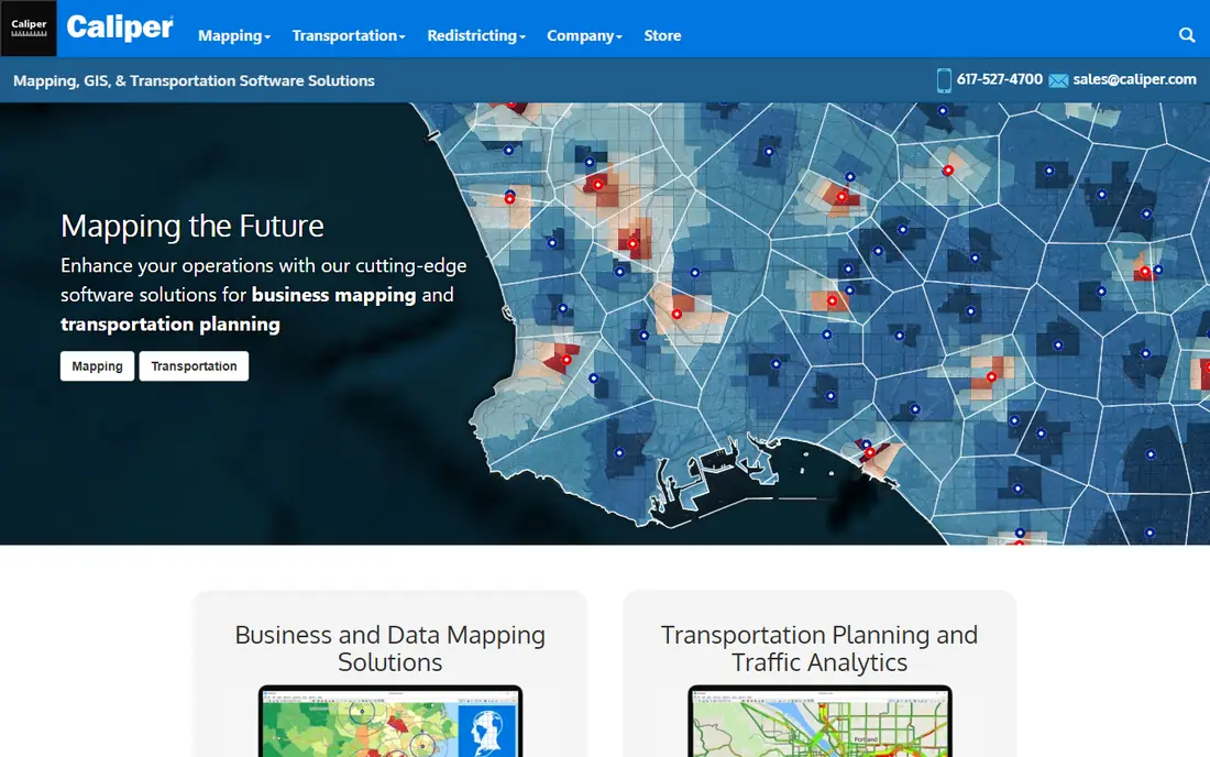
Maptitude is the most direct successor in spirit to MapPoint for business mapping. You can plot customer lists, color areas by sales or population data, build territories, and print or export maps for presentations. That mix matters for sales managers and franchise planners who still think in territories rather than single routes.
The trade-off is that it is a desktop product with a learning curve. It is not a quick phone app for directions, and its full value shows only when you work with real location data. If your main need is daily driving routes, a route planner below will be faster to use.
- Strong territory tools
- Includes demographic data options
- Works on Windows desktop
- Windows only for the main desktop version
- Pricing is harder to compare at a glance
QGIS is a free, open source geographic information system used by planners, analysts and students around the world. It can display maps, join spreadsheet data to places, create styled maps, and run spatial analysis that goes far beyond basic directions. For a small business with a skilled user, it removes the software cost entirely.
The catch is time. Menus and tools assume some mapping knowledge, and you must find your own base maps and data. If you want a guided, business-ready setup out of the box, Maptitude or ArcGIS Online will feel easier, even though they cost money.
- Free to download and use
- Very wide mapping and analysis tools
- Large community and plugins
- Steeper learning curve
- No vendor support unless you pay a third party
ArcGIS Online, from Esri, lets teams create, share and use web maps without installing desktop software on every machine. Staff can view the same map, add field data, and use apps for collection and dashboards. That shared setup suits councils, utilities, larger sales teams and firms that already use Esri tools.
For a single user who only needs a printed territory map, it may be more than needed. Pricing depends on user types and credits, so get a clear quote for your team size before you commit. Still, for shared mapping work, it is the most established cloud option here.
- Strong web sharing and collaboration
- Large map and data library
- Works across devices
- Can be costly at scale
- Some tools feel complex for simple tasks
Route4Me focuses on turning a list of addresses into an ordered route for one driver or a whole fleet. You can import stops, set time windows, dispatch routes to a mobile app, and track progress. That makes it a practical MapPoint replacement for delivery, service and sales teams that live by the daily route.
The main drawback is pricing clarity. Business pricing is not a simple published monthly rate, so small teams should ask what is included before they sign. If you only plan a handful of stops, a simpler and cheaper planner may do the same job.
- Handles large stop lists
- Driver apps and tracking options
- Territory tools
- Pricing is quote based for business plans
- Some features sit in higher tiers or add-ons
Badger Maps is aimed at field salespeople rather than couriers. It helps reps plan a day of customer visits, see accounts on a map, log visits, and find nearby leads. That blend of mapping and customer detail is close to how many MapPoint users worked with sales territories.
If you only need the shortest driving route and proof of delivery, a delivery-focused tool will fit better. Badger Maps earns its place when the route is a sales day, with meetings, notes and follow-ups attached to each stop.
- Built for field sales visits
- Route planning plus customer records
- Mobile app for reps on the road
- Less suited to pure delivery dispatch
- Value depends on using its sales features
OptimoRoute plans routes around delivery windows, driver hours, vehicle capacity and service time. Customers can get tracking updates, and dispatchers can see where drivers are during the day. That makes it a strong choice for food, parcel, laundry and field service delivery.
Smaller teams should test the workflow on a real route before buying, since the benefit grows with stop count and driver count. Solo drivers with ten stops a day may find a simpler app enough, while teams with several drivers will get more from its planning rules.
- Clear route planning for delivery teams
- Live tracking and customer updates
- Handles driver schedules
- Paid plans only for full use
- Advanced setup takes care for large fleets
Circuit keeps route planning simple. Add stops, optimize the order, and send the route to a driver app with navigation and delivery confirmation. Couriers, small retailers and local delivery teams often pick it because setup takes minutes rather than days.
The limit is depth. It does not try to be a full fleet management system, so firms that need complex scheduling, vehicle maintenance or deep reporting may outgrow it. For straightforward daily routes, that simplicity is the point, and it keeps training costs low.
- Easy to learn
- Fast route optimization for drivers
- Proof of delivery options
- Fewer deep fleet tools than larger platforms
- Pricing varies by plan and driver count
MapQuest is a free web mapping service for directions, distance checks and local searches. It is useful when a former MapPoint user only needs to look up an address, plan a single trip, or check drive time between two places. There is no install and no bill.
It is not a replacement for territory mapping or fleet dispatch. You cannot build rich demographic maps or manage a driver team in it. Use it as a free everyday tool, and pair it with a paid planner when routes or territories become a daily job.
- Free to use on the web
- Easy directions and route planning
- Local business search
- No advanced territory analysis
- Route tools are basic compared with paid planners
Bing Maps, from Microsoft, is the natural free starting point for former MapPoint users who stayed in the Microsoft world. It gives road maps, aerial imagery, directions and traffic views in a browser, with no software to install. For quick checks and shared links, it works well.
Like MapQuest, it does not replace a full mapping suite. There is no territory builder or customer data analysis of the kind MapPoint offered. Treat it as a handy free map, not as a business planning system, and move to Maptitude or QGIS when data work matters.
- Free web maps and directions
- Clear road and aerial views
- Easy to share a location
- Basic routing features
- No desktop territory suite
Routific is built for small delivery businesses that want optimized routes without a long setup. You can upload stops, set delivery windows, and send routes to drivers, who follow them in a mobile app. Bakeries, pharmacies, florists and local couriers are typical users.
The honest limit is scale. Very large fleets with complex depots, shift rules and live re-planning may need a larger platform. For a team with a few drivers and a daily stop list, Routific hits a good balance of price, speed and ease of use.
- Optimized routes for small fleets
- Driver app with navigation
- Easy stop imports
- Best for smaller fleets
- Larger operations may need deeper dispatch tools
How we picked these
We compared official product pages, pricing pages, app store listings and public documentation for mapping, territory and route tools that still work in October 2026. We left out discontinued software and tools that only show a static map with no planning use. We favored tools that cover a clear MapPoint job: territory maps, customer mapping, or multi-stop routes, and we mixed free, desktop and cloud options so readers with different budgets can find a fit.
What to check before you choose
Start with the job, not the brand. If you map sales data and build territories, shortlist Maptitude and QGIS, and test them with your own customer file. If you plan driver routes every day, shortlist Route4Me, OptimoRoute, Circuit and Routific, and run the same stop list through each one during a trial.
Check three practical points in every trial. First, test address accuracy in your service area, since a planner that misses rural addresses will waste driver time. Second, confirm how stops, drivers and tracking are priced, since some tools charge per driver, per route or per plan tier. Third, check export and sharing options, so maps and routes can reach staff, customers or printed reports without extra work.
Free tools and paid tools
Free tools suit lookups and basic analysis, while paid tools suit daily commercial work. QGIS is the exception: it is free and powerful, but it needs skill and time. Do not judge a free map by its price alone, and do not assume a paid route planner will fix bad address data. A short trial with real stops will tell you more than any feature list.
Frequently asked questions
Is MapPoint still available?
No. Microsoft discontinued MapPoint years ago, and it is no longer sold or supported. The tools in this guide are current options for mapping, territory planning and route planning.
What is the closest replacement for MapPoint?
Maptitude is the closest desktop match for territory maps and demographic data. QGIS is the closest free match for mapping and analysis, while Route4Me is a closer match if your main MapPoint use was route planning.
Can I use a free tool instead of MapPoint?
Yes, for many tasks. QGIS covers mapping and analysis at no software cost, and MapQuest and Bing Maps cover free directions and lookups. Paid tools add easier setup, support and team features.
Do these tools work on a phone?
Route planners such as Route4Me, Badger Maps, OptimoRoute, Circuit and Routific offer mobile apps for drivers and field staff. Desktop mapping tools such as Maptitude and QGIS are mainly for computers, with web options for sharing.
How do I move my MapPoint data to a new tool?
Export your lists to a spreadsheet format such as CSV where possible, then import that file into the new tool and check that addresses match. Test a small sample first, since older files may need address cleanup before they map correctly.
Which tool is best for delivery routes?
For small teams, Circuit and Routific are easy starting points. For larger delivery work with tracking and time windows, OptimoRoute and Route4Me offer more control. Run the same daily route in two tools during trials to compare drive time and ease of use.
Sources
See where you really rank - block by block
ProMapRanker scans Google Maps across a grid of your service area. Simple monthly plans from $19, white-label on every plan.
Start freeKeep reading
 wpforms alternatives
Best WPForms Alternatives in 2026
We compare 9 wpforms alternatives for WordPress forms, with free and paid options, current pricing notes, and honest limits for small business sites in 2026.
Read → windows task scheduler alternatives
Best Windows Task Scheduler Alternatives in 2026
Looking for Windows Task Scheduler alternatives? We compare 9 schedulers for Windows and cross-platform work, from free tools to enterprise automation.
Read → which ai video service is best
Which AI Video Service Is Best in 2026
which ai video service is best? We compare 10 legitimate AI video services on price, avatars, editing and output quality to help you pick the right tool.
Read →