 ProMapRanker
Best Hunting Apps in 2026: 8 Apps Compared


Property lines and multi-state hunting · Pricing starts at: $34.99 per year
Key takeaways
- onX Hunt is the standard for property lines and landowner data, while HuntStand gives the best value with a genuinely useful free tier.
- Offline maps matter more than any prediction feature, since cell signal fails in many hunting areas.
- HuntWise and Spartan Forge add movement prediction, but treat every forecast as a guide, not a guarantee.
- GOHUNT suits Western big-game hunters who need draw odds and unit research, while Gaia GPS suits backcountry navigation beyond hunting.
- Property lines in an app are a guide, not a legal survey, so confirm access and local rules before you hunt.
Quick comparison
| Pick | Great for | Pricing starts at | Free tier | |
|---|---|---|---|---|
| onX Hunt | Property lines and multi-state hunting | $34.99 per year | Free trial | Visit |
 HuntStand | Best value mapping with a free tier | Free | Yes | Visit |
 HuntWise | Weather-driven deer movement forecasts | Free | Yes | Visit |
 Gaia GPS | Backcountry navigation and offline maps | Free | Yes | Visit |
 BaseMap | 3D maps and rangefinder tools | $39.99 per year | Yes | Visit |
 GOHUNT | Western draw odds and unit research | See website | No | Visit |
 Spartan Forge | Deer movement prediction with LiDAR maps | $79.99 per year | Free trial | Visit |
 Infinite Outdoors | Booking vetted private land hunts | Free | Yes | Visit |
The best hunting apps
A hunting app has one core job: show you where you are, whose land you are on, and how to get back safely. Prediction tools, trail camera features and draw research are useful extras, but they do not replace good maps, offline access and local knowledge. We compared official pricing pages, app listings and feature descriptions for apps that work in the US in October 2026.
Hunting rules and licences vary by state and season, and an app does not replace the regulations published by your state wildlife agency. Check season dates, licence needs, bag limits and land access rules for your exact location before you hunt, and treat app boundary lines as a guide to confirm, not as a legal survey.
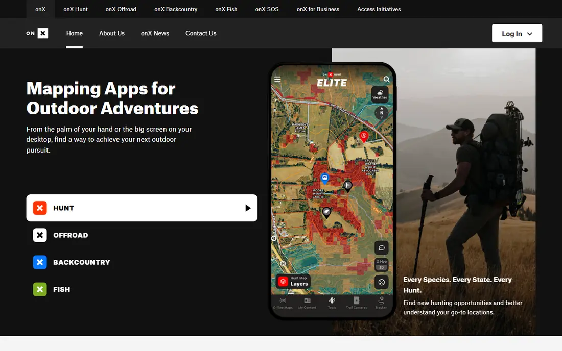
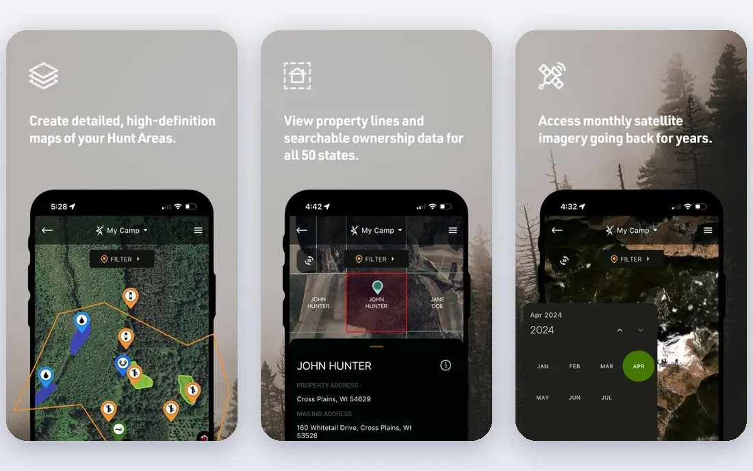
onX Hunt is the app most hunters compare everything else against, and the reason is mapping depth. Premium at $34.99 per year covers one state, Premium Two-State is $49.99 per year, and Elite at $99.99 per year covers all 50 states, with property lines, landowner names, offline maps and a wide set of map layers. Waypoints, tracking and sharing make it easy to plan a hunt with a group and find your way back.
The cost is the main drawback for hunters who stay in one state and hunt a few weekends a year. A trial lets you test the maps, but there is no full free tier. Parcel records can also lag behind a recent sale, so confirm permission before you cross onto private ground. For public-land hunters and multi-state hunters, onX remains the most complete mapping choice.
- Strong property line and landowner data
- Offline maps
- Tools for waypoints, tracking and sharing
- No true free tier beyond a trial and basic features
- Elite at $99.99 per year is costly for one-state hunters
- Parcel data can lag behind recent sales
HuntStand is the best starting point if you want to try hunting maps without paying. The free tier gives real mapping and marking tools, and Pro at around $35 per year adds nationwide parcel data, landowner details and fuller weather and scouting features on published terms. That price makes it one of the best-value paid options for private-land and lease hunters.
The free tier has clear limits. Parcel boundaries and landowner lookup sit behind the paid tier, and offline maps need a paid plan, so download maps before you lose signal. Trail camera photo logging and group features help hunters who manage a property together. If you hunt mainly in one area and want a low-cost map that grows with you, HuntStand is a smart first download.
- Genuinely useful free tier
- Pro around $35 per year on published terms
- Property, weather and trail camera tools
- Full parcel and landowner data need a paid tier
- Offline maps are paid-only
- Some advanced features are desktop-only
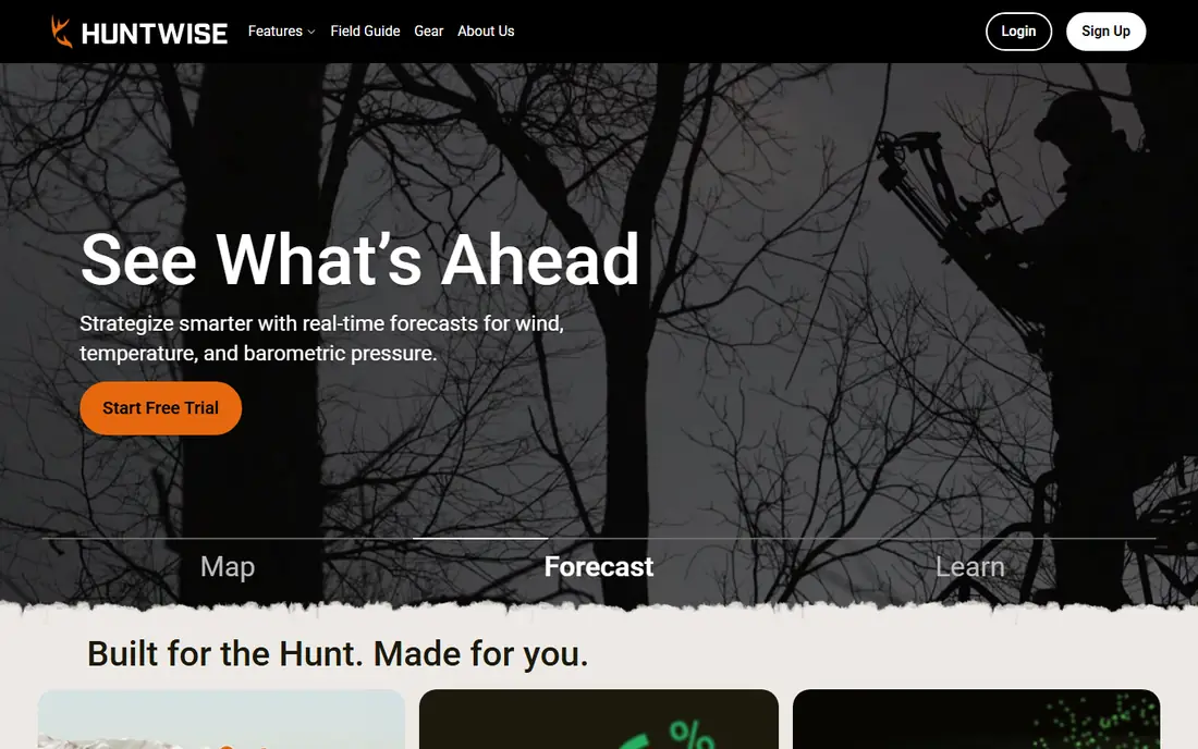
HuntWise builds its appeal around HuntCast, a daily score that combines barometric pressure, wind, temperature, moon phase and historical movement for your location and species. That helps whitetail hunters decide which morning to take off work, and the mapping underneath covers public and private boundaries across the US. The free tier gives a useful taste of both mapping and forecasts.
Pro, at around $60 per year on published terms, adds nationwide property lines and landowner lookup. That makes HuntWise cheaper than onX Elite for hunters in three or more states, though more expensive than a single-state onX plan. Treat the movement score as a planning aid. Weather, pressure and local sign matter, but no app can promise that an animal will appear.
- HuntCast movement score from weather and moon data
- Full US mapping on the free tier on published terms
- Public and private boundaries
- Pro at around $60 per year on published terms
- Predictions are estimates, not guarantees
- Landowner lookup needs Pro
Gaia GPS is a general backcountry navigation app that many hunters use alongside a hunting map. It records tracks, plans routes, saves waypoints and downloads maps for offline use, which matters when you are miles from a signal. The free tier covers basic planning and tracking, while paid memberships add more map sources and features. Published premium pricing has varied by bundle, so check the current plan before you pay.
Gaia GPS does not replace a parcel app. It lacks the hunting-focused landowner layer that onX and HuntStand put at the centre, so hunters who need ownership data should pair it with one of those apps. For backcountry trips, scouting hikes and navigation in rough terrain, Gaia GPS is one of the most capable tools available, and it stays useful all year for hiking and camping too.
- Strong offline maps and route planning
- Wide map sources
- Useful well beyond hunting season
- No hunting-specific parcel or landowner layer as its core feature
- Premium pricing varies by bundle
- Learning curve for new map users
BaseMap gives hunters a strong middle option between budget maps and premium mapping. Pro at $39.99 per year includes nationwide parcel boundaries and owner names, unlimited offline use, hundreds of map layers and 3D mapping. Rangefinder mapping, which marks ranged targets on the map, is a useful extra for hunters who use a laser rangefinder in the field.
Higher tiers add a rescue membership and, at Pro Ultimate for $99.99 per year, hunt planner tools with draw odds and season data. Those extras raise the price quickly, so most hunters should start with Pro and add a tier only if the rescue or draw features matter to them. BaseMap suits hunters who want 3D terrain and rangefinder tools without paying Elite-level prices.
- Pro at $39.99 per year with parcel boundaries and owner names
- 3D maps and offline use
- Rangefinder mapping tools
- Higher tiers add cost for rescue and draw tools
- Some features are platform-specific
- Interface takes time to learn
GOHUNT answers a different question from the mapping apps: which unit should you apply for, and what are your odds? It combines draw odds, unit-by-unit research, harvest statistics and species detail with maps, which helps Western hunters planning out-of-state trips where a wasted tag is expensive. That research depth is the reason serious Western hunters pay more for it.
The price reflects that focus. Published comparisons put GOHUNT in the region of $170 per year, far above a basic mapping subscription. Hunters who only chase whitetail in their home state will not need most of its research tools. For elk, mule deer and other Western species, where the draw decides the season, GOHUNT can save far more than its cost in avoided mistakes.
- Deep draw odds, unit data and harvest statistics
- Species-specific research for Western big game
- Maps alongside research tools
- Costs more than basic mapping apps, around $170 per year on published comparisons
- Overkill for Eastern whitetail-only hunters
- Pricing needs checking at signup
Spartan Forge pairs mapping with a deer movement model trained on GPS collar data, plus LiDAR terrain imagery that reveals subtle ground features under tree cover. Pricing starts at $79.99 per year, with a monthly option at $12.99 and a 7-day trial on published terms. Offline maps, land ownership layers, weather and group pins round out a tool built for serious whitetail scouting.
The price and focus are the limits. At $79.99 per year, Spartan Forge costs more than HuntStand Pro or a single-state onX plan, and its prediction strength is centred on deer. LiDAR coverage, while strong, does not cover every area equally. For dedicated deer hunters who scout hard and value terrain detail, it is a compelling pick. For general hunters, a broader mapping app may offer better value.
- Deer movement model built on collar data
- LiDAR terrain and detailed aerial imagery
- Offline maps and land ownership layers
- $79.99 per year is high for a single-species focus
- Predictions remain estimates
- Some LiDAR coverage is incomplete
Infinite Outdoors solves access rather than mapping alone. It lists vetted private properties that hunters can book for a season or species, with free land layers and 3D mapping tools to scout before booking. An Access+ membership at $49.99 per year on published terms adds benefits, while booking fees vary by property.
That model suits hunters who lack private land access and do not want to pay outfitter prices for every trip. Coverage depends on listings near you, so check your area before you rely on it. Infinite Outdoors works best alongside a mapping app: book the ground through Infinite Outdoors, then navigate and mark it with onX, HuntStand or BaseMap.
- Vetted private properties to book directly
- Free public and private land layers
- 3D mapping and e-scouting tools
- Booking costs are extra and vary by property
- Coverage depends on listed land in your area
- Not a full parcel mapping replacement
How we picked these
We compared official pricing pages, app listings and feature descriptions for hunting apps that work in the US in October 2026. We favoured apps with offline maps, property or public-land layers, and a clear hunting use, from mapping to prediction to access booking. We left out apps that have stopped development, apps with no US hunting maps, and apps whose main job is unrelated to hunting.
What to check before you choose
Start with where and how you hunt. A one-state whitetail hunter needs different tools from a multi-state Western hunter or a backcountry hunter. Download the free tier or trial, map a property you know well, and check whether boundaries, trails and offline maps match what you see on the ground.
Offline maps, safety and battery
Download offline maps before every trip, carry a charged phone and a backup power pack, and tell someone your plan and return time. An app cannot replace a compass, a paper map and basic navigation skills when a phone dies or breaks. In remote areas, consider a satellite communicator for emergencies, and check local rules on devices and drones where they apply.
Boundaries, permission and seasons
App boundaries are drawn from county and public records, which can lag behind sales and surveys. Always confirm land ownership and permission before you hunt private ground, and follow posted signs and local rules. Check your state wildlife agency for season dates, licence needs and bag limits, since an app summary can be out of date.
Frequently asked questions
What is the best hunting app overall?
onX Hunt is the best overall mapping app for most hunters, thanks to its property lines, landowner data and offline maps. HuntStand is the best value alternative, with a useful free tier and a lower-cost Pro plan. The best choice depends on how many states you hunt and whether you need prediction or draw research as well.
What is the best free hunting app?
HuntStand has the most useful free tier among hunting-specific apps, with real mapping and marking tools. HuntWise and Gaia GPS also offer free tiers, though full parcel data and offline maps usually need a paid plan. Test the free tier on a property you know before you pay for any app.
What is the best hunting map app for property lines?
onX Hunt leads for property lines and landowner data, especially for multi-state hunters on Elite. HuntStand Pro, HuntWise Pro and BaseMap Pro also offer parcel boundaries and owner names at lower prices. Confirm any boundary on the ground and with the landowner before you hunt, since app data can lag behind records.
Do hunting apps work without cell service?
Yes, if you download offline maps before you go. onX Hunt, HuntStand, Gaia GPS, BaseMap and Spartan Forge all support offline maps on paid plans. GPS on your phone works without a cell signal, but live features such as group sharing need a connection. Always download maps for your exact area in advance.
Are hunting app predictions accurate?
Movement predictions from HuntWise and Spartan Forge are informed estimates based on weather, moon and movement data, not guarantees. They help you pick a good morning, but local sign, wind on the day and hunting pressure matter just as much. Use predictions to plan, not to decide whether a hunt is worth going on at all.
Do I still need a licence if I use a hunting app?
Yes. An app does not grant a licence, permission or access rights. Hunting rules and licences vary by state and season, so check your state wildlife agency for the licence, tags, season dates and land rules that apply to you. An app helps you navigate and plan, but the legal responsibility stays with you.
Sources
See where you really rank - block by block
ProMapRanker scans Google Maps across a grid of your service area. Simple monthly plans from $19, white-label on every plan.
Start freeKeep reading
 free alternatives to grok imagine
Free Alternatives to Grok Imagine in 2026
We compared the best free alternatives to grok imagine for image generation, from fast daily credits to design tools, so you can create without paying.
Read → best tools for instagram content creation
Best Tools for Instagram Content Creation in 2026
Compare the best tools for Instagram content creation, from Canva and CapCut to Later and Buffer, on design, video, planning, scheduling, and price in 2026.
Read → best tool to split pdf files
Best Tool to Split PDF Files in 2026
We compared the best tool to split pdf files on split modes, file limits, privacy and price, so you can split a PDF cleanly and keep every page in one go.
Read →