 ProMapRanker
Best Geography Apps in 2026: 9 Apps Compared

Key takeaways
- The best geography app depends on the skill you want: map memory, place recognition, exploration, or quiz knowledge.
- Seterra and Lizard Point suit drilling countries and capitals, while GeoGuessr trains reading real places from street-level clues.
- Google Earth suits exploration and classroom projects, and Sporcle suits quiz lovers who want huge variety.
- Most of these tools are free or have a free tier, so try two that train different skills rather than collecting many similar quiz apps.
Quick comparison
| Pick | Great for | Pricing starts at | Free tier | |
|---|---|---|---|---|
 Google Earth | Exploring the world in 3D | Free | Yes | Visit |
 GeoGuessr | Guessing places from street views | Free | Yes | Visit |
 Seterra | Drilling maps, capitals, and flags | Free | Yes | Visit |
 Sporcle | Geography quizzes of every kind | Free | Yes | Visit |
 Sheppard Software | Gentle learning for beginners | Free | Yes | Visit |
 Lizard Point | Fast no-login map quizzes | Free | Yes | Visit |
 World Geography Games | Classroom map games | Free | Yes | Visit |
 National Geographic Kids | Geography for younger learners | Free | Yes | Visit |
 PeakVisor | Mountains, peaks, and terrain | Free | Yes | Visit |
The best geography apps
A good geography app does more than ask quiz questions. The best app for geography teaches you to read a map, recognize a place, or explore a region with curiosity. We compared apps and web tools that work on phones, tablets, or browsers, and we grouped them by the skill each one trains best.
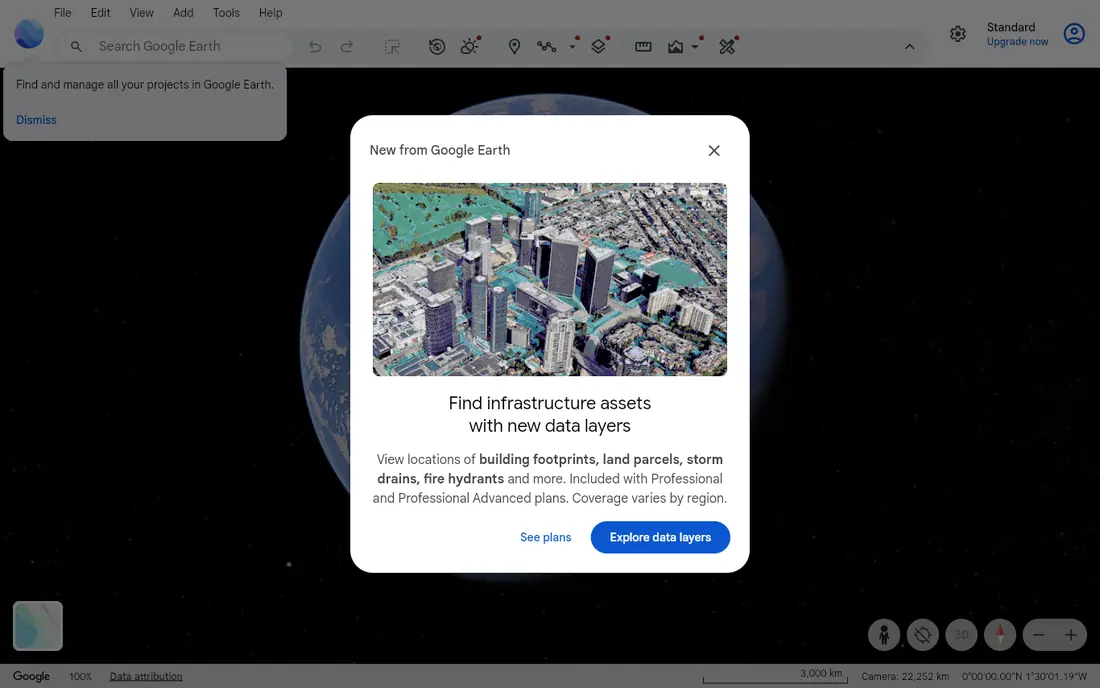
Google Earth is the best starting point for curiosity. You can zoom from a world view to a single street, tilt terrain to see mountain ranges, and measure distances between places. Teachers use it for virtual field trips, and travelers use it to preview a route, a coastline, or a national park before a trip.
It will not drill you on capitals, so pair it with a quiz app if your goal is a test or a trivia night. Used on its own, though, it builds the spatial sense that quizzes alone cannot teach: where places sit in relation to each other, how terrain shapes settlement, and how large countries really are. That sense is the foundation of geography.
- Satellite imagery and 3D terrain for the whole planet
- Measuring and tour tools
- Strong for classroom projects
- Not a quiz app, so it does not test memory
- Needs a good internet connection for detailed imagery
- Some features work better on desktop

GeoGuessr drops you into a random street view and asks you to guess where you are. You read road signs, vegetation, architecture, driving side, and language clues, then place a pin on the map. That process teaches geography in a way that memorizing lists cannot, because you learn to connect visible evidence with regions.
The free version lets you try the core game, while a Pro subscription adds more maps and modes. Beginners should start with country or famous-place maps before tackling the full world map, which can feel harsh at first. For teens, adults, and classrooms that enjoy competition, GeoGuessr is the most engaging geography game here.
- Real street-level imagery from around the world
- Competitive maps and daily challenges
- Trains observation of signs, plants, and roads
- Full access needs a paid Pro plan
- Requires an account for many features
- Can frustrate beginners on hard maps
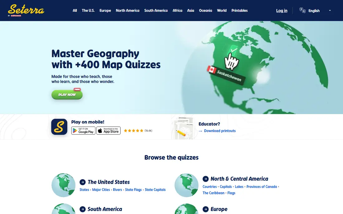
Seterra is the drill tool for anyone who wants to learn a map properly. Quizzes cover world countries, US states, European capitals, rivers, flags, and many regional maps, with timed modes and score tracking. You can repeat a weak map until the locations stick, which is exactly how map memory forms.
The format is simple by design, so it will not entertain a child who wants a story or a game world. For students preparing for a test, travelers learning a new region, or adults who want to finally learn African or Asian geography, Seterra is the most efficient tool in this list. Short daily sessions beat long cramming sessions.
- Hundreds of map quizzes for countries, capitals, and regions
- Tracks progress and scores
- Works on web and mobile
- Drill format can feel repetitive
- Some advanced content needs a subscription
- Less exploration than Google Earth
Sporcle is a quiz platform with a deep geography section, from naming all countries to listing US state capitals, world rivers, and flags. The timed typing format rewards recall speed, and the sheer variety means you can find a quiz for almost any topic, including historical geography and obscure regions.
Sporcle complements map apps rather than replacing them. It tests what you know, but it does not show you where places sit on a map in the same way Seterra does. Use it for fun challenges with friends, trivia practice, and revision after you have learned a map elsewhere. A free account covers most quizzes, with an optional membership removing ads.
- Enormous quiz library beyond geography
- Timed typing quizzes
- User-created quizzes for niche topics
- Free version includes ads
- Quiz quality varies by creator
- Typing format suits recall more than map skills
Sheppard Software suits beginners, younger learners, and anyone returning to geography after a long gap. Tutorials introduce continents, countries, and states in stages, then quizzes test each stage before moving on. That gentle progression helps learners who feel overwhelmed by a full world map on the first try.
The site looks dated next to GeoGuessr or Google Earth, and it works best in a browser rather than as a polished mobile app. Those limits matter less in a classroom or at a kitchen table, where the goal is steady learning. If you want a calm, free, step-by-step route into geography, start here.
- Progressive levels from easy to hard
- Clear tutorials before quizzes
- Free browser access with no account needed
- Website design feels older
- Fewer mobile app features
- Limited competitive or social play
Lizard Point is the no-fuss option. Open the site, pick a map, study it, then take the quiz, with no account or download in the way. Teachers like the printable maps, and self-learners like the speed: you can drill European countries for ten minutes without signing up or watching ads pile up.
The range is narrower than Seterra, and there is less tracking of long-term progress. For quick revision, homework, or a classroom warm-up, that simplicity is a strength. If you want deep progress tracking and hundreds of maps, pair Lizard Point with Seterra rather than choosing only one.
- No account needed
- Fast map quizzes with a study mode
- Printable maps for classrooms
- Smaller quiz range than Seterra
- Simple design
- No progress tracking without extra steps
World Geography Games offers a wide set of browser games covering countries, capitals, flags, and physical features. The variety helps teachers rotate activities so students do not tire of one drill format, and the free access means a whole class can play without accounts or purchases.
Quality varies from game to game, and the site carries ads, so preview a game before using it with younger students. For classroom variety and free access, it is a useful addition to Seterra and Sheppard Software. At home, it works well for short, focused practice sessions.
- Many map games for world and regional geography
- Free browser play
- Suits classroom use
- Design varies across games
- Ads on the free site
- Less polished than app-first tools
National Geographic Kids mixes geography with animals, cultures, and the environment, which keeps younger learners interested longer than a bare map drill. Interactive maps, quizzes, and short articles introduce continents, countries, and habitats in a way that feels like exploration rather than homework.
Older students and adults will outgrow the depth quickly, so treat this as a starting point for primary-age children. For that age group, it is one of the safest and most engaging options here, and it pairs well with Google Earth for exploring the places children read about.
- Trusted educational brand
- Maps, quizzes, and animal content together
- Engaging for primary-age children
- Content is aimed at younger children
- Less depth for teens or adults
- Some features vary by region
PeakVisor teaches physical geography through mountains. Point your phone camera at a range, and it labels peaks, shows elevation, and maps trails around you. That turns a hike into a geography lesson about terrain, watersheds, and how mountain ranges run across continents.
It is not a general geography app: it will not teach capitals or flags. Its value is depth in one area, and for hikers, climbers, and outdoor classrooms, that depth is excellent. If your interest is physical geography rather than political maps, PeakVisor belongs on your phone alongside Google Earth.
- Identifies mountain peaks through the camera
- Detailed terrain and trail maps
- Works offline in some modes
- Focused on mountains, not general geography
- Best in mountain regions
- Some features need a paid plan
How we picked these
We compared official app and website pages, store listings, and public feature lists for geography apps and web tools available in the US in 2026. We favored tools that teach a real geography skill, work on phones or browsers without complex setup, and offer a free version. We did not test every quiz in each library, and where a paid plan adds extra content, we note that instead of quoting a price we could not verify.
What to check before you choose
Match the app to the learner first. A primary-age child needs National Geographic Kids or Sheppard Software, a student facing a test needs Seterra or Lizard Point, and an adult who loves puzzles will enjoy GeoGuessr most. An app that fits the wrong age or goal will sit unused, however good its reviews are.
Next, mix two skills. Pair a map drill app with an exploration tool, such as Seterra plus Google Earth, or a quiz platform with a place-recognition game, such as Sporcle plus GeoGuessr. That mix builds both memory and understanding, and it keeps practice from feeling like the same drill every day.
Finally, keep sessions short and regular. Ten minutes of map practice most days builds lasting knowledge faster than a single long session before a test. For children, preview games first, check privacy settings, and use the app together for the first few sessions so you can talk about the places you find.
Frequently asked questions
What is the best geography app?
The best geography app depends on your goal. Seterra is best for learning maps and capitals, GeoGuessr is best for recognizing real places, and Google Earth is best for exploring the world. Many learners use two apps together, one for drilling and one for exploration.
What is the best app for geography for kids?
National Geographic Kids and Sheppard Software suit younger learners best, with gentle content and clear progression. Seterra also works for older children who are ready for timed map quizzes. Preview any app first, and start with your child's region or country before moving to world maps.
Is there a free geography app?
Yes. Google Earth, Seterra, Sporcle, Sheppard Software, Lizard Point, World Geography Games, and National Geographic Kids all offer free access. GeoGuessr and PeakVisor offer free tiers with paid plans for extra maps and features. Free versions cover most learning needs.
Which geography app helps with capitals and flags?
Seterra offers dedicated quizzes for capitals, flags, countries, and regions, while Sporcle offers many capital and flag quizzes in typing format. Lizard Point also covers capitals on several maps. For flags alone, search within Seterra or Sporcle for the flag quiz set you need.
Can geography apps help with school tests?
Yes, especially Seterra, Lizard Point, and Sheppard Software, which drill the exact map and capital knowledge many school tests require. Use the study mode first, then timed quizzes, and repeat weak maps on later days. Google Earth helps with understanding, while quizzes help with recall under time pressure.
What is the best geography game for adults?
GeoGuessr is the most popular geography game for adults, thanks to real street views and competitive play. Sporcle suits adults who enjoy timed trivia, and Seterra suits adults who want to learn a region properly. Try the free versions of all three and keep the one you return to most often.
Sources
See where you really rank - block by block
ProMapRanker scans Google Maps across a grid of your service area. Simple monthly plans from $19, white-label on every plan.
Start freeKeep reading
 wpforms alternatives
Best WPForms Alternatives in 2026
We compare 9 wpforms alternatives for WordPress forms, with free and paid options, current pricing notes, and honest limits for small business sites in 2026.
Read → windows task scheduler alternatives
Best Windows Task Scheduler Alternatives in 2026
Looking for Windows Task Scheduler alternatives? We compare 9 schedulers for Windows and cross-platform work, from free tools to enterprise automation.
Read → which ai video service is best
Which AI Video Service Is Best in 2026
which ai video service is best? We compare 10 legitimate AI video services on price, avatars, editing and output quality to help you pick the right tool.
Read →