 ProMapRanker
Best Property Line App in 2026

Key takeaways
- Parcel data in these apps comes from county and public records, so lines can be out of date or off by several feet, especially at edges and corners.
- LandGlide is the most parcel-focused pick, while onX Hunt and HuntStand add outdoor navigation, offline maps, and landowner data for field use.
- Free options such as Google Maps and the basic tiers of hunting apps can help with a rough check, but they often lack parcel detail or offline maps.
- Always confirm access and ownership with the landowner, a posted sign, or the managing agency before you enter land, since an app color is not legal permission.
- This article is not a substitute for a licensed survey where boundaries are disputed, or where a fence, building, or sale depends on the exact line.
Quick comparison
| Pick | Great for | Pricing starts at | Free tier | |
|---|---|---|---|---|
 LandGlide | Parcel data and owner search | $9.99 per month | Free trial | Visit |
 onX Hunt | Private and public land in the field | $29.99 per year | Free trial | Visit |
 HuntStand | Value hunting and land mapping | See website | Yes | Visit |
 BaseMap | Budget hunting maps with parcel layers | See website | Yes | Visit |
 Acres | Land research and parcel maps | See website | Free trial | Visit |
 MapPad | Walking and measuring a property line | See website | Yes | Visit |
 Google Maps | Quick free rough check | Free | Yes | Visit |
 Regrid | Web parcel research by address | See website | Yes | Visit |
The best property line app
App lines are a planning aid, not a legal survey. Use them to find a parcel, check owner data, and plan a visit, then confirm the exact boundary with a surveyor or county record when money, a fence, or a dispute is involved.
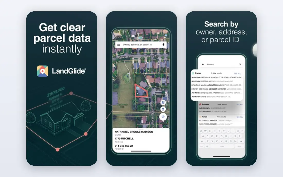
LandGlide is built for parcel work first, with property boundary overlays, parcel records, and search by owner, address, or parcel number. It covers a very large share of US parcel records in published descriptions, which helps buyers, agents, and landowners check a lot quickly. GPS positioning lets you see where you stand relative to a parcel line while you are on site.
Pricing is $9.99 per month or $99.99 per year after a seven-day free trial in published summaries. That cost is justified if you research land often, but it is high for a one-time check. Parcel lines still depend on county data, so treat them as a guide and confirm the record with the county assessor when a decision depends on it.
- Parcel-focused design
- Owner and address search
- Works on web and mobile
- Monthly price adds up
- Parcel accuracy varies by county
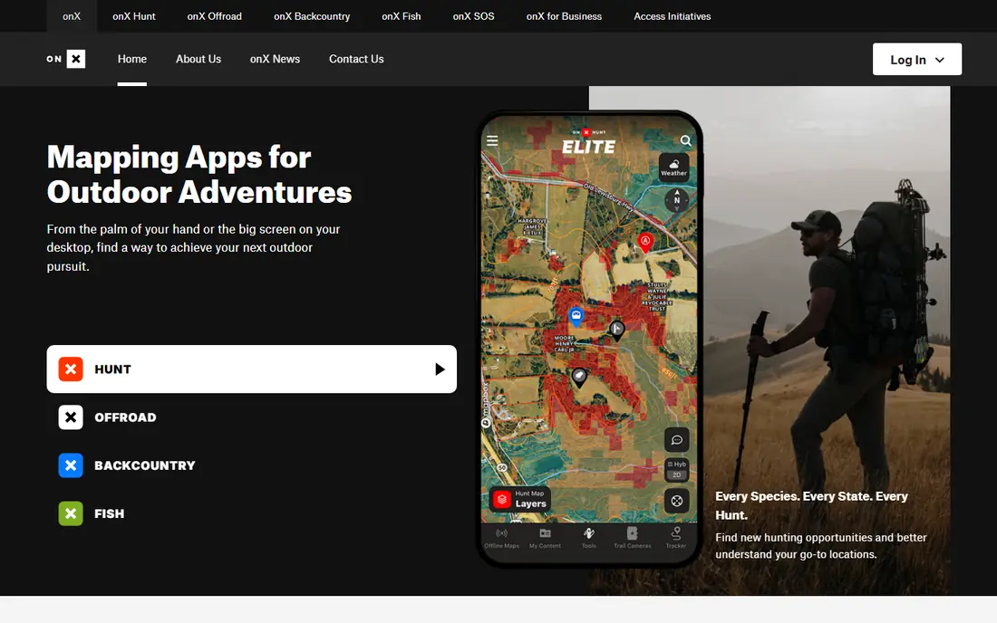
onX Hunt is the standard field app for hunters and land users, with private land boundaries, landowner names, public land layers, and offline maps. Premium pricing starts at $29.99 per year for one state, with two-state and Elite nationwide options at higher annual prices, and a seven-day free trial for new users. Offline downloads help in areas with no signal, which is common on rural land.
The company notes that private land data is updated every one to two years in published summaries, and accuracy can vary by county, often within five to ten feet where data is good. That margin matters at a fence line, so do not use the app to place a fence or settle a dispute. Use it to plan, stay well inside a boundary, and confirm access before you enter.
- Strong private and public land layers
- Offline maps
- Landowner data
- Property lines are not a survey
- Data updates vary by county
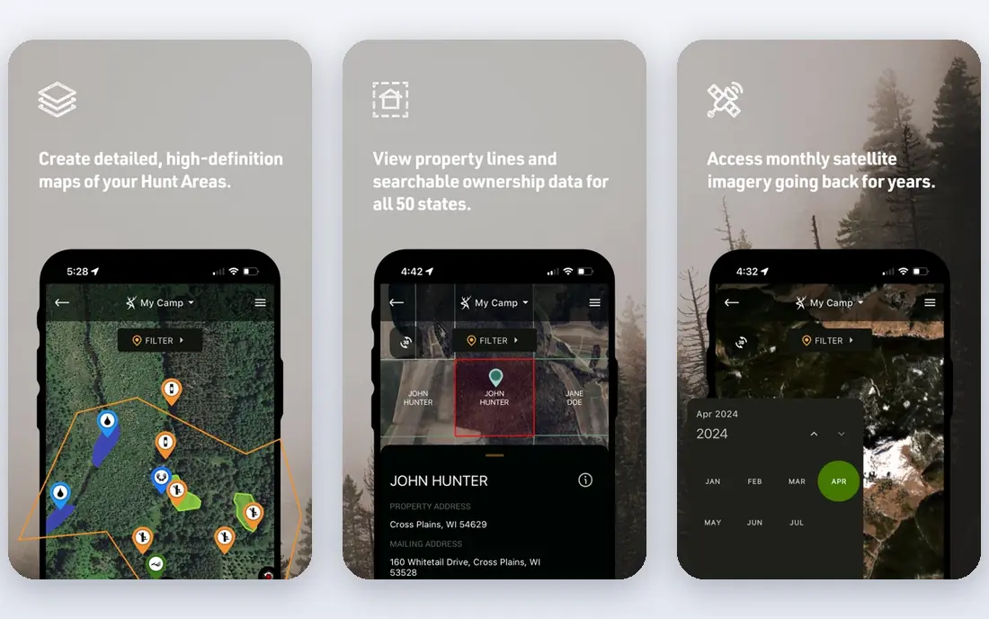
HuntStand offers a free tier with basic GPS mapping and 3D views, while Pro adds nationwide property lines, ownership data, satellite imagery, and unlimited offline maps. Published summaries list Pro around $29.99 to $34.99 per year, with an Ultimate tier at $99.99 per year, but prices vary by promotion, so check the current site before you buy. The free tier makes it a good first test for interface and map quality.
The trade-off is that the most useful parcel features require Pro, and the app is still a hunting tool first, not a parcel research database. For a hunter or landowner who wants mapping, weather, and property data in one app at a low annual price, HuntStand is strong value. For deep parcel research, pair it with LandGlide or a county record search.
- Usable free tier
- Property lines on Pro
- Offline maps and 3D views
- Parcel detail sits behind Pro
- Prices vary by promotion and tier
BaseMap is a hunting mapping app that also works as a property line tool, with parcel boundaries and landowner information on paid tiers, plus offline maps and navigation tools. It appeals to users who want a lower-cost alternative to onX Hunt for scouting, lease checks, and land visits. The interface is straightforward, and the map layers cover public and private land in a similar way to its rivals.
The limit is depth and coverage in some areas, since parcel data quality still depends on county sources, and some advanced hunting features are still developing. Pricing is published on the vendor site and varies by tier, so use the current page rather than older guides. For a budget field app with parcel layers, BaseMap is worth a trial alongside HuntStand.
- Lower-cost hunting maps
- Parcel and landowner layers on paid tiers
- Offline maps
- Parcel depth varies
- Smaller feature set than onX Hunt
Acres is a land data app focused on parcel maps, ownership, and acreage, which suits buyers, agents, and landowners researching a property before a visit. You can search parcels, view boundaries, and review land details in a map view that is simpler than a full hunting app. That focus helps when your main job is research, not navigation or hunting planning.
The trade-off is field use. Acres is less built for offline navigation, tracking, and hunting layers than onX Hunt or HuntStand, so a field visit may still need a second app. Pricing and free trial terms are listed on the vendor site and vary, so confirm coverage for your county before you subscribe. Use Acres for research, then confirm the parcel with county records.
- Land-focused parcel maps
- Owner and acreage data
- Useful for buyers
- Less of a field navigation app
- Pricing and coverage need checking
MapPad is a measurement app that lets you walk a boundary, drop points, and measure area, distance, and perimeter with phone GPS. It suits a landowner who wants a rough size check, a fence plan sketch, or a quick record of a walked line. The simplicity is the point: you open the app, walk, and get a measurement without a complex map layer setup.
The limit is important. MapPad does not replace a parcel database, and phone GPS accuracy can vary with signal, tree cover, and device quality, so a walked line can be off by several feet. It also does not provide owner data or county parcel records. Use it for rough planning and field notes, and use a parcel app plus a surveyor for any legal or construction decision.
- GPS area and distance measurement
- Simple field use
- Useful for rough checks
- Not a parcel database
- Accuracy depends on phone GPS
- Limited owner data
Google Maps can show property lines in some locations when you search an address and zoom in closely, which makes it a useful free first check. It is familiar, fast, and available on almost every phone, and satellite view helps you match a line to visible features such as fences, roads, and tree lines. For a quick sense of a lot shape, it costs nothing to try.
The limits are clear. Property lines are not available in all locations, they are not a full parcel database, and Google Maps does not provide owner data or survey-grade accuracy. Do not rely on it for a purchase, a fence, or a dispute. Use it to orient yourself, then move to a parcel app or county record for detail.
- Free
- Familiar
- Works on web and mobile
- Satellite view
- Property lines are limited and inconsistent
- No parcel owner data in most places
Regrid is a web parcel platform with nationwide parcel maps, address search, and property data, which suits desktop research before a site visit. You can view parcel boundaries, lot details, and owner information where data is available, and filter by location or parcel traits for land research. The web focus makes it easy to share a parcel view with a buyer, agent, or surveyor.
The trade-off is mobile field use, since Regrid is primarily a web tool rather than a hunting navigation app with offline maps. Advanced datasets and exports sit behind paid plans, and pricing varies by product, so check the current site for the plan that fits your use. For research at a desk, Regrid pairs well with a field app such as onX Hunt or HuntStand.
- Web parcel maps
- Address and owner search
- Useful for desktop research
- Field app is limited
- Advanced data sits behind paid plans
How we picked these
We compared official product pages, app store listings, and recent property app guides, and we kept only apps that are live in October 2026 and show parcel lines, owner data, or GPS measurement in a real way. We favored a mix of parcel databases, field navigation apps, and free rough-check tools, since readers range from buyers to hunters to landowners. We also flagged accuracy limits clearly, because parcel data quality varies by county and by data source.
How to check a property line safely
Start on the web with a parcel app or county assessor site, and note the parcel number, owner name, and lot size. Then check the same parcel in a second source, since a mismatch often points to an old record or a split lot. On site, use GPS only as a guide, stay well inside the apparent boundary, and look for fences, markers, and posted signs, which may reflect the real use better than a screen line.
If the line matters for a fence, a building, a sale, or a dispute, hire a licensed surveyor and get the result in writing. A surveyor will check deeds, markers, and county records, and will place the line with professional accuracy that an app cannot match. Keep the survey, the deed, and any county printout together, since that file set is what a buyer, a neighbor, or a court will ask for later.
Frequently asked questions
What is the best app for property lines?
LandGlide is the best parcel-focused app for owner and boundary research, while onX Hunt is the best field app for private and public land use. For value, HuntStand Pro offers property lines at a low annual price. The best pick depends on whether you need desktop research, field navigation, or both.
What is the best app for finding property lines for free?
Google Maps is free and can show property lines in some locations, but coverage is inconsistent and it lacks owner data. HuntStand and BaseMap offer free tiers, but parcel lines usually sit behind paid tiers. For a free parcel check, try your county assessor site first, since it is the source many apps use.
What is the best app to find property lines by address?
LandGlide, Acres, and Regrid all support address search with parcel overlays, which helps when you know a street address but not a parcel number. Enter the full address, check the parcel number against the county record, and confirm the lot shape on satellite view. If two sources disagree, trust the county record and ask a surveyor.
What is the best land survey app?
No phone app replaces a licensed survey, but MapPad is useful for walking and measuring a rough line, while LandGlide and onX Hunt are useful for parcel research. For a legal survey, hire a licensed surveyor in your state, since only a surveyor can certify a boundary for a sale, a fence, or a dispute.
Are property line apps accurate?
They are useful for planning, but not survey-accurate. Parcel data comes from county records that can be out of date, and phone GPS can be off by several feet, with onX Hunt noting accuracy often within five to ten feet where data is good. Treat app lines as guides, keep a margin at edges, and confirm exact lines with a surveyor when it matters.
What is the best free property line app?
Google Maps is the most accessible free option for a rough check, but it is limited. For a fuller free start, try the free tiers of HuntStand or BaseMap, or the free web access on Regrid, then check your county assessor site. A free app is fine for orientation, but not for a purchase or a boundary dispute.
Sources
See where you really rank - block by block
ProMapRanker scans Google Maps across a grid of your service area. Simple monthly plans from $19, white-label on every plan.
Start freeKeep reading
 best subscription manager app
Best Subscription Manager App in 2026
Find the best subscription manager app for your budget with our 2026 comparison of 8 apps, covering automatic detection, renewal alerts and free plans.
Read → best stock picking service
Best Stock Picking Service in 2026
Compare the best stock picking service options for 2026, with 8 stock recommendation services for long-term, dividend, quant, growth and income investors.
Read → best software wallet
Best Software Wallet in 2026
Compare the best software wallet options for 2026, with 8 crypto wallets for desktop and mobile, covering self-custody, supported chains, fees and security.
Read →