 ProMapRanker
Best Marine GPS App in 2026: 9 Apps Compared


Detailed charts for most boaters · Pricing starts at: See website
Key takeaways
- Navionics Boating is the safest default for most US boaters, with detailed charts, SonarChart data, and Garmin plotter links.
- Savvy Navvy suits sailors and passage makers who want weather routing and departure planning in one app.
- Wavve Boating suits recreational boaters in shallow water, with draft-aware depth shading as its standout feature.
- Argo Navigation and OpenCPN suit budget boaters, with a strong free tier and a fully free option respectively.
- No phone app replaces proper seamanship, paper backup, or a dedicated plotter on a larger vessel, and charts must be downloaded before leaving coverage.
Quick comparison
| Pick | Great for | Pricing starts at | Free tier | |
|---|---|---|---|---|
| Navionics Boating | Detailed charts for most boaters | See website | Free trial | Visit |
 Savvy Navvy | Weather routing and passage planning | Free | Yes | Visit |
 Wavve Boating | Shallow-water recreational boating | See website | Free trial | Visit |
 Argo Navigation | Budget boating with community data | Free | Yes | Visit |
 Aqua Map | US coastal charts and USACE data | See website | No | Visit |
 iNavX | Multi-chart flexibility | See website | No | Visit |
 C-MAP | Classic vector charts | See website | No | Visit |
 OpenCPN | Free chartplotter software | Free | Yes | Visit |
 SeaPilot | Coastal navigation and AIS | See website | No | Visit |
The best marine GPS apps
These nine apps cover coastal cruising, sailing, fishing, and shallow-water boating. We compared official app listings, chart coverage, offline support, and pricing material, and we focused on US boaters. Safety note: use these apps alongside official charts, local knowledge, and proper safety gear. Phone GPS and battery limits make any single app a poor sole source of navigation on open water.
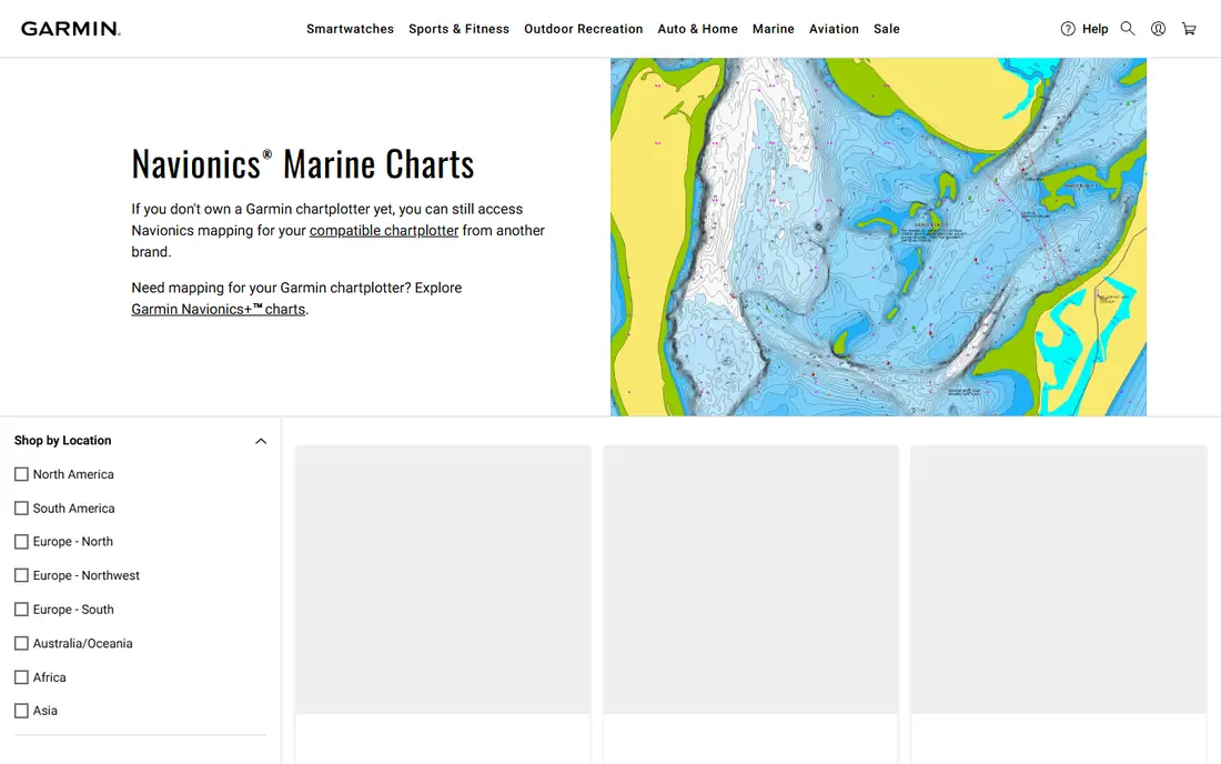
Navionics Boating, from Garmin, is the most widely used marine app for good reason. Its charts cover US coastal and inland waters in detail, with depth contours, buoys, wrecks, and marina data, plus SonarChart layers built from community sonar logs. Offline charts, routes, and tracks work after download, which matters offshore.
Pricing varies by region and subscription tier, with recent material placing US and Canada coverage around $49.99 per year, so confirm the current price in the app store. Navionics suits most recreational boaters as a primary app or as a backup to a dedicated plotter. Sailors who want automated weather routing may still add Savvy Navvy.
- Detailed vector charts
- SonarChart community depth data
- Links with Garmin plotters
- Subscription pricing varies by region
- Advanced routing is less automated than Savvy Navvy
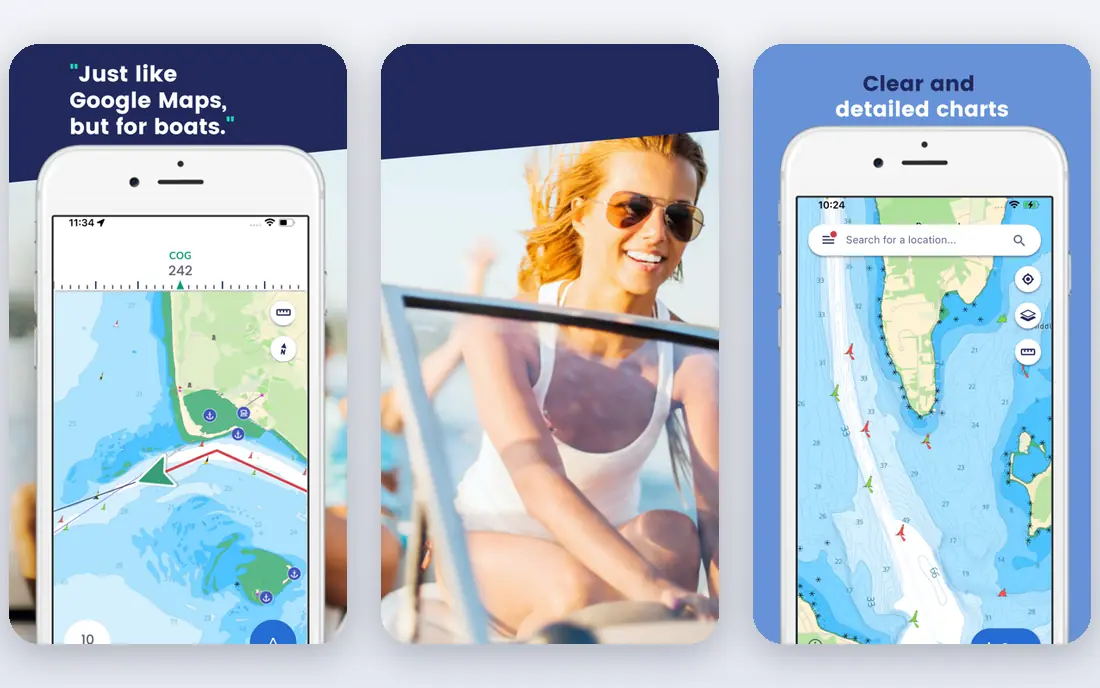
Savvy Navvy is built for sailors and cruisers who plan passages, not just day trips. Its routing considers wind, weather, and tides, and departure planning helps a crew pick a safer window. Charts are clear and modern, and offline support on premium tiers helps on longer trips.
Premium pricing is higher than Navionics, with recent material placing it around $99 to $169 per year depending on tier and region, so confirm the current price before subscribing. For coastal day boating, that premium may be more than needed. For passage making, the routing alone can justify it.
- Smart weather and tidal routing
- Departure planning
- Clear chart presentation
- Full premium pricing is higher than Navionics
- Free tier is limited outside the US
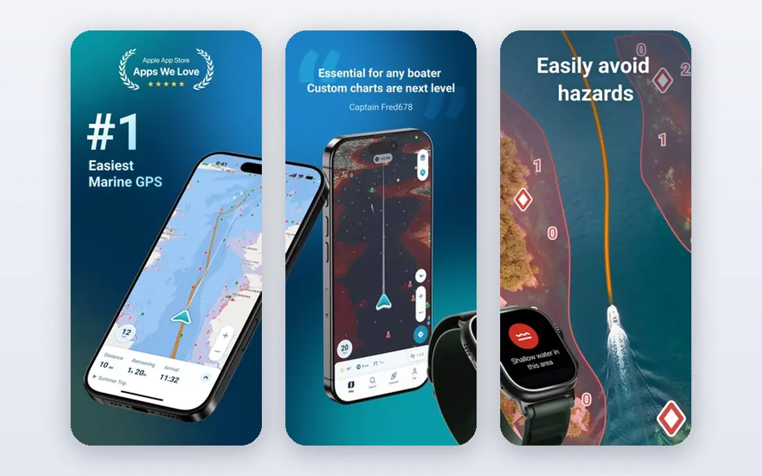
Wavve Boating stands out for shallow-water boaters. Enter your vessel draft and the app shades water too shallow for safe passage, with tide adjustments changing that picture through the day. That single feature helps on the Intracoastal Waterway, in bays, and around shifting sandbars where a standard chart can mislead.
Recent material places Wavve around $69.99 per year with a trial, but confirm current pricing on the site. The interface is simpler than iNavX or OpenCPN, which suits beginners and weekend boaters. Serious offshore sailors may still want Savvy Navvy or Navionics alongside it.
- Draft-aware depth shading
- Tide-adjusted views
- Simple interface for beginners
- Coverage and pricing vary
- Smaller chart ecosystem than Navionics
Argo Navigation is the best budget pick for North American boaters. The free tier covers basic navigation, community reports, and marina information, while Premium, listed around $39.99 per year in recent material, adds offline charts and custom depth shading. That free entry makes Argo easy to test on real water.
Limits show on longer trips. Offline access and advanced shading sit behind Premium, and coverage outside North America is thinner. For lake and coastal day boaters who want a capable free app, Argo is a strong starting point before paying for Navionics or Savvy Navvy.
- Strong free tier
- Community reports and marina data
- Premium adds offline charts
- Offline charts need Premium
- Depth shading is manual on Premium
Aqua Map suits US coastal boaters who want detailed survey data. It includes US Army Corps of Engineers data in many areas, plus NOAA charts, tides, and weather layers, which helps in channels and inlets where official survey detail matters. Offline charts support trips beyond cell coverage.
The app is more technical than Wavve or Argo, and chart regions are bought separately, so total cost depends on cruising area. Anglers and coastal cruisers who study bottom detail will value it. Casual boaters may prefer the simpler setup of Navionics.
- Detailed US coastal data including USACE surveys
- Offline charts
- Good for fishing and cruising
- Interface is more technical
- Chart purchases add cost beyond the app
iNavX is the flexible choice for experienced boaters. It supports charts from several providers, including NOAA raster charts and commercial vector charts, and it can link to onboard instruments via NMEA over Wi-Fi. Waypoints, routes, tracks, and anchor alarms cover serious cruising needs.
That flexibility comes with complexity. Setup, chart purchases, and instrument links take time to learn, and total cost depends on chart choices. iNavX suits boaters who already understand charts and want one app for multiple sources. Beginners should start with Navionics or Wavve instead.
- Supports many chart providers
- NMEA instrument links
- Waypoint and route tools
- Learning curve is steep
- Chart costs vary by provider and region
C-MAP, from Navico, provides vector charts used in many plotters and boating apps. Its chart library covers coastal and inland waters broadly, with depth, navigation aids, and marina data. Boaters with compatible Lowrance, Simrad, or B and G equipment may already use C-MAP charts on board.
The app route matters. C-MAP charts appear inside partner apps and plotters, so the interface and price depend on the chosen app and region. Check which app will display your C-MAP charts before buying a region, and confirm offline support for your cruising area.
- Established vector chart library
- Broad coverage
- Works with compatible plotters and apps
- App experience varies by partner app
- Pricing depends on chart region
OpenCPN is free chartplotter software for Windows, Mac, Linux, and Android, with support for NOAA charts and other formats. It offers routes, tracks, tides, AIS display with compatible hardware, and plugins for weather and instruments. For planning at home or as a backup system, it is unmatched at zero cost.
Setup is the barrier. Chart downloads, plugin choices, and instrument links need technical comfort, and the phone experience is less polished than Navionics or Savvy Navvy. Technically minded boaters and cruisers on a budget will get the most from OpenCPN, especially as a second system.
- Fully free and open source
- Supports many chart formats
- Strong for planning and backup use
- Setup is technical
- Mobile experience is weaker than dedicated phone apps
SeaPilot offers clean vector charts, AIS traffic display, and straightforward route tools for coastal navigation. Its presentation suits boaters who want a clear chart without a crowded interface, and AIS helps in busy channels where commercial traffic matters.
Coverage is strongest in European waters, so US boaters should check chart detail for their cruising area before subscribing. For European coastal cruising, SeaPilot is a credible alternative to Navionics. For US waters, Navionics, Aqua Map, or Argo usually offer deeper local detail.
- Clean coastal charts
- AIS vessel display
- Route and track tools
- Coverage is strongest in Europe
- US boaters should check regional chart detail
How we picked these
We compared official app listings, chart coverage, offline support, routing features, and pricing material, and we favored apps that are actively maintained in October 2026 with real chart data, not just a map view. We included budget, recreational, sailing, and technical options so different boaters are covered. We left out discontinued apps, road GPS apps without marine charts, and apps without offline chart support.
What to check before you head out
Download charts for your full cruising area before leaving cell coverage, and test the app in airplane mode at the dock. Check that GPS, tides, and depth units match your vessel and local practice, and confirm that routes avoid shallow water at low tide. Carry a charged backup device, a paper chart or a second app, and standard safety gear on every trip.
Match the app to your waters
Shallow-water boaters should prioritize draft-aware shading in Wavve or custom shading in Argo Premium. Sailors should prioritize weather routing in Savvy Navvy. Coastal cruisers should prioritize chart detail in Navionics or Aqua Map. Technical boaters should prioritize chart choice and instrument links in iNavX or OpenCPN.
Battery, GPS, and backup planning
Phone GPS works without cell signal, but chart downloads, screen brightness, and AIS layers drain battery fast. Bring a charging cable and a power bank, mount the device where it stays dry and readable, and never rely on a single phone as the only navigation source. A dedicated plotter, a second device, or paper charts provide the backup that open water demands.
Frequently asked questions
What is the best marine GPS app overall?
Navionics Boating is our safest overall pick for most US boaters because of chart detail, offline support, and Garmin links. Savvy Navvy leads for sailing and passage routing, while Wavve Boating leads for shallow-water recreation. Test two apps on familiar water before trusting one offshore.
What is the best boating navigation app for beginners?
Wavve Boating and Argo Navigation are the friendliest starting points, with clear interfaces and strong free or trial options. Navionics is also beginner-friendly once charts are downloaded. Start on familiar lakes or bays, learn chart symbols, and practice route planning before a longer trip.
Can a phone app replace a dedicated chartplotter?
A phone app works well as a primary tool on small boats and as a backup on larger vessels, but it does not fully replace a waterproof, sunlight-readable, hardwired plotter. Screen size, battery life, and water resistance all limit phones. Many boaters run both, with the app for planning and the plotter for helm navigation.
Do marine GPS apps work without cell signal?
Yes, if charts are downloaded in advance and the device GPS is on. Phone GPS does not need cell towers, but live weather, AIS, and community updates do need a connection. Always download charts and test offline mode before leaving coverage.
What is the best free marine GPS app?
Argo Navigation offers the strongest free tier for North American boaters, and OpenCPN is fully free for planning and backup use. Free tiers usually limit offline charts or advanced routing, so budget boaters should check which features sit behind a paid plan for their cruising area.
Sources
See where you really rank - block by block
ProMapRanker scans Google Maps across a grid of your service area. Simple monthly plans from $19, white-label on every plan.
Start freeKeep reading
 twitch alternatives
Twitch Alternatives in 2026
Explore the best Twitch alternatives in 2026 for live streaming, with free platforms, monetisation options, audiences, chat tools, and tips for new streamers.
Read → firebase alternatives
Best Firebase Alternatives in 2026
Looking for Firebase alternatives? We compare 9 backend platforms for auth, databases, realtime, storage, functions, self-hosting, and pricing for your app.
Read → companies with best work life balance
Companies With Best Work Life Balance in 2026
See companies with best work life balance in 2026, ranked by employee ratings, with flexible work options, benefits, and what to check before applying.
Read →