 ProMapRanker
Best Map Apps for Road Trips in 2026

Key takeaways
- Google Maps is still the best all-round road trip map, because it combines routing, live traffic, saved places and offline maps in one free app.
- Roadtrippers and Wanderlog are the best planning apps, with Roadtrippers stronger for roadside discovery and Wanderlog stronger for group planning.
- Waze is best as a second navigation app for live hazard and traffic reports, rather than as the only planner for a multi-day trip.
- Download offline maps before leaving, because the best routes often pass through areas with weak or no mobile signal.
Quick comparison
| Pick | Great for | Pricing starts at | Free tier | |
|---|---|---|---|---|
 Google Maps | All-round navigation and planning | Free | Yes | Visit |
 Waze | Live traffic and hazard alerts | Free | Yes | Visit |
 Apple Maps | iPhone users and CarPlay | Free | Yes | Visit |
 Roadtrippers | Roadside stops and multi-stop routes | $49.99 per year | Yes | Visit |
 Wanderlog | Group trip planning | Free | Yes | Visit |
 HERE WeGo | Offline maps and simple navigation | Free | Yes | Visit |
 Sygic | Offline navigation with speed alerts | See website | Yes | Visit |
 Komoot | Scenic routes and outdoor detours | Free | Yes | Visit |
The best map apps for road trips
A road trip needs two kinds of map: one for planning stops before departure, and one for live navigation on the road. The apps below cover both jobs, and most trips work best with a planner plus a navigator rather than a single app.
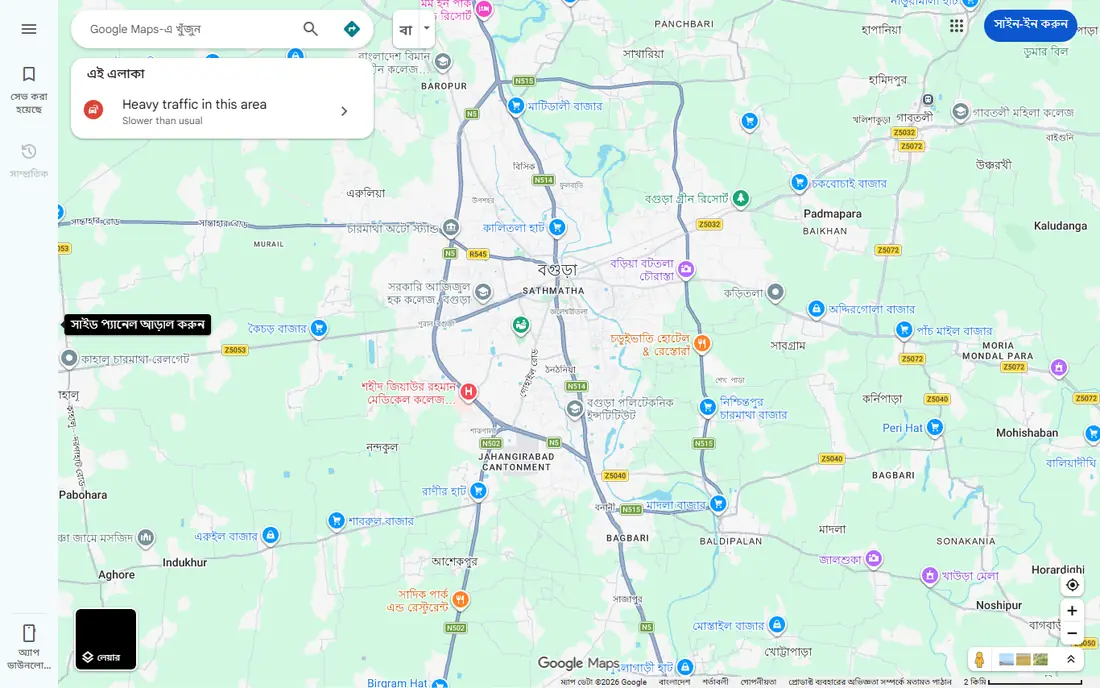
Google Maps remains the default road trip navigator for good reason. It covers driving routes in most countries, gives live traffic and rerouting, and holds reviews, hours and photos for stops along the way. A traveller can save places to a list, build a rough route, and share it with passengers, all without paying. Offline maps add a safety net for national parks and rural stretches where signal drops.
The limits show on longer, complex trips. Adding many stops and reordering them is clumsier than in Roadtrippers or Wanderlog, and place details can be out of date, so a fuel stop or cafe listed as open may in fact be closed. Battery drain is also real on long driving days. We would use Google Maps as the main navigator and daily driver, and pair it with a dedicated planner for a multi-day itinerary.
- Live traffic, rerouting and place data in one free app
- Saved places and lists for trip planning
- Offline maps for areas without signal
- Multi-stop planning is less flexible than a dedicated trip planner
- Business hours and place data can be out of date
- Heavy use drains battery
Waze is built around its community. Drivers report accidents, hazards, road closures and speed cameras, and other drivers see those reports in near real time. That makes Waze strong on busy highways and in cities, where a few minutes of warning can save a long delay. Fuel price reports also help on a long drive, when a cheaper station a few miles ahead is worth a short detour.
Waze is weaker as a planner. It does not handle multi-day itineraries, saved stop lists or detailed trip budgets, and its live features need a connection, so it cannot replace an offline map in remote areas. We would run Waze alongside Google Maps on busy legs, or use it as the main navigator for a single-day drive, and keep planning in a separate app.
- Community reports on hazards, police, roadworks and closures
- Fast rerouting around traffic
- Fuel price reports in many areas
- No strong multi-stop trip planning
- Interface is busier than Google Maps
- Needs a data connection for live reports
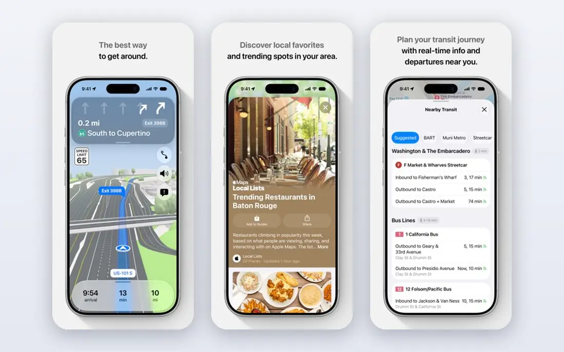
Apple Maps is the natural choice for iPhone users, because it is built in, works well with CarPlay, and pairs with Siri for hands-free directions. Its city guides and detailed maps help in urban stops, and its design stays calm on a long drive, with clear lane guidance at complex junctions. For a traveller who already uses an iPhone, there is no setup to do.
The limits are platform and planning depth. Android users cannot use it, place coverage can be thinner in rural areas, and multi-stop road trip planning is more basic than Roadtrippers. We would pick Apple Maps as the main navigator for an iPhone-only household, and still use a dedicated planner for a trip with many stops.
- Clean design and strong CarPlay integration
- Detailed city maps and guides
- Privacy-focused approach to location data
- Available only on Apple devices
- Place coverage varies outside major cities
- Multi-stop planning is basic
Roadtrippers is the planner most road trippers actually enjoy using. It shows attractions, diners, parks and odd roadside stops along a route, and it lets a user build a multi-stop trip with fuel cost estimates and notes for each stop. Campers and RV drivers get extra value from campground data and vehicle-size routing on paid plans, which a general map app does not offer.
The free plan is limited in stops, so a long trip needs a paid plan, and coverage outside its core countries is thinner. Roadtrippers also plans rather than navigates, so most users send the finished route to Google Maps or Waze for driving. We would pick Roadtrippers for a US road trip where discovery matters as much as arrival, and accept the paid plan as part of the trip cost.
- Large database of roadside attractions and stops
- Multi-stop routes with fuel cost estimates
- RV and camping features on paid plans
- Free plan limits stops
- Coverage focuses on the US, Canada, Australia and New Zealand
- Paid plans are needed for full features
Wanderlog is the best free planner for a group trip. It allows unlimited stops on the free plan, lets several people edit the same itinerary, and tracks budgets and shared expenses. That combination suits friends or family planning together, because everyone can add places, comment and see the same map without paying. Route optimisation also helps when the order of stops is not obvious.
Discovery is less road-trip-specific than Roadtrippers, so a user looking for quirky roadside attractions may need to search elsewhere. Offline access and some extras sit behind a paid Pro plan, and Wanderlog does not navigate, so the finished plan still goes to a navigation app. We would pick Wanderlog for group planning and budgeting, and Roadtrippers when roadside discovery is the main goal.
- Free unlimited stops for basic planning
- Group planning with shared editing and notes
- Budget tracking and expense splitting
- Paid Pro needed for offline access and some features
- Discovery is weaker than Roadtrippers for roadside stops
- Navigation is via other apps
HERE WeGo earns its place as a backup map. It lets users download maps for whole regions for free, then navigate offline with turn-by-turn directions. That matters on a road trip through mountains, deserts or national parks, where the main map app may lose signal for long stretches. A downloaded HERE map can keep the car moving when other apps show a blank screen.
The trade-off is depth. Place reviews, photos and business details are thinner than Google Maps, and live traffic varies by region. HERE WeGo is not the app for discovering a great cafe, but it is a strong safety net. We would install it before departure, download the regions on the route, and keep it as the offline backup alongside Google Maps.
- Free offline maps for whole regions
- Simple turn-by-turn driving navigation
- Works well as a backup when signal fails
- Place data and reviews are thinner than Google Maps
- Live traffic coverage varies by region
- Interface feels dated
Sygic is a paid-leaning offline navigator with a long history on mobile. It offers downloadable maps, lane guidance, speed limit displays and warnings, and it works with CarPlay and Android Auto. Drivers who cross borders or drive in areas with patchy data often value a map that does not depend on a live connection for its core job.
The free tier covers basic navigation, but premium features, map updates and extras sit behind paid plans, so the total cost depends on the features chosen. Place search is also weaker than Google Maps, so finding a specific restaurant may take an extra search elsewhere. We would pick Sygic for a driver who wants a dedicated offline navigator with speed alerts, and keep Google Maps for place discovery.
- Offline maps with lane guidance
- Speed limit and speed camera warnings in many regions
- CarPlay and Android Auto support
- Some features need a paid premium plan
- Map updates and extras add cost over time
- Place search is weaker than Google Maps
Komoot is best known for cycling and hiking, but it earns a road trip place for scenic detours. It plans routes that favour interesting roads over the fastest highway, and it highlights community routes with photos and notes. A road tripper who wants a scenic loop, a lakeside detour or a short hike from a parking stop will find Komoot more inspiring than a fastest-route navigator.
Car routing is not its core job, so a full multi-day car itinerary is better built in Roadtrippers or Wanderlog. Some map regions need a purchase, and offline use sits in a paid bundle. We would use Komoot for the scenic legs and outdoor stops of a trip, and keep Google Maps or Waze for the main highway driving.
- Route planning for scenic driving, cycling and hiking detours
- Turn-by-turn voice navigation
- Community route highlights and photos
- Road trip car routing is not its main focus
- Some regions need a paid map purchase
- Offline maps sit behind a paid bundle
How we picked these
We compared official feature pages, app store listings and recent road trip guides, and we kept only map apps that are available now and cover driving routes, trip planning or offline navigation. We checked prices against vendor pages and recent comparisons, and we used See website where a vendor lists several paid tiers rather than a single starting price. We did not claim hands-on testing, and we favoured apps that cover both planning and driving, with extra weight for offline maps and live traffic.
How to build a road trip map stack
Use three apps, not one, and set them up the night before departure. Build the itinerary in Roadtrippers or Wanderlog, send the daily legs to Google Maps or Apple Maps for navigation, and download offline maps in Google Maps and HERE WeGo for the whole route. Add Waze on busy highway days for hazard reports, and check fuel prices in advance rather than while driving.
Test the stack on a short local drive before a long trip. Check that CarPlay or Android Auto shows the chosen navigator, that offline maps open with data off, and that passengers can see the shared itinerary. Pack a car charger and a phone mount, because navigation with the screen on drains battery fast, and a dead phone on a remote road is a bigger problem than a missed turn.
Frequently asked questions
Which map app is best for road trips overall?
Google Maps is our pick overall, because it combines routing, live traffic, place data and offline maps for free. For planning, add Roadtrippers for discovery or Wanderlog for group trips, since Google Maps alone is weaker for multi-stop itineraries.
Is Roadtrippers worth paying for?
Roadtrippers is worth paying for on a longer US road trip where roadside stops matter, because the free plan limits stops and paid plans add more stops, RV features and offline access. For a short trip with few stops, the free plan or Wanderlog may be enough.
Can I use these map apps offline?
Yes, with preparation. Google Maps, HERE WeGo and Sygic all allow offline map downloads, and Wanderlog and Roadtrippers offer offline access on paid plans. Download maps over Wi-Fi before departure and test them with mobile data off.
Does Waze work for a multi-day road trip?
Waze works well for daily driving and traffic alerts, but it is not a multi-day planner. Use a planner for the itinerary and stops, then use Waze or Google Maps for each day of driving.
Which app is best for scenic routes?
Komoot is our pick for scenic detours, because it plans routes that favour interesting roads and outdoor stops. Roadtrippers also helps by showing attractions along a route, while Google Maps tends to favour the fastest road.
Do I need a data plan for road trip maps?
A data plan helps for live traffic, place updates and rerouting, but offline maps cover basic navigation without one. Download maps in advance, and use Wi-Fi at stops to refresh the itinerary and check closures.
Sources
See where you really rank - block by block
ProMapRanker scans Google Maps across a grid of your service area. Simple monthly plans from $19, white-label on every plan.
Start freeKeep reading
 bitly alternatives
Bitly Alternatives in 2026: 8 Tools Compared
Compare the best Bitly alternatives for branded short links, with free tiers, custom domains, analytics, and pricing that suits creators and small teams.
Read → bill.com alternatives
Best Bill.com Alternatives in 2026
Looking for bill.com alternatives? We compared 9 bill pay and AP automation tools on price, approvals, and accounting sync to help you switch with confidence.
Read → betterhelp alternatives
BetterHelp Alternatives in 2026
We compared BetterHelp alternatives for online therapy, covering Talkspace, Grow Therapy, Rula, Brightside and more on price, insurance and format in 2026.
Read →