 ProMapRanker
Best Map Apps for Road Closures in 2026

Key takeaways
- Waze is the strongest choice for live closure and hazard reports from other drivers, especially on busy roads.
- Google Maps is the best all-round choice, with closures, traffic, place search, and offline maps in one app.
- Apple Maps suits iPhone drivers who want clean directions and incident reports without extra clutter.
- Download offline maps before rural trips, because live closure reports need a connection to stay current.
Quick comparison
| Pick | Great for | Pricing starts at | Free tier | |
|---|---|---|---|---|
 Waze | Live driver-reported closures | Free | Yes | Visit |
 Google Maps | All-round maps and closures | Free | Yes | Visit |
 Apple Maps | Clean iPhone navigation | Free | Yes | Visit |
 HERE WeGo | Offline maps and traffic | Free | Yes | Visit |
 TomTom GO | Traffic-aware driving | Free | Yes | Visit |
 Sygic | Offline navigation with traffic | Free | Yes | Visit |
 MapQuest | Simple web and mobile routes | Free | Yes | Visit |
 OsmAnd | Open offline maps | Free | Yes | Visit |
 Bing Maps | Web-based route checks | Free | Yes | Visit |
The best map apps for road closures
No map app knows every closure, and a closure can appear after you set off. Use two sources on important trips, and always follow road signs and local authority notices over an app route.
For many readers, the first question is fit, not features. Waze is built around driver reports for crashes, hazards, roadworks, and closures, and it reroutes quickly when conditions change.
The catch is connection: without data, live reports stop, so it is not the best sole app for remote areas with weak signal. Before you commit, check the current pricing and terms on the official site, because plans and limits change. We compared official feature pages, pricing pages, and app store listings for this guide, and we did not claim hands-on testing that did not happen.
- Fast incident and closure reports
- Rerouting around traffic
- Voice reporting
- Needs a connection for live data
- Ads in the app
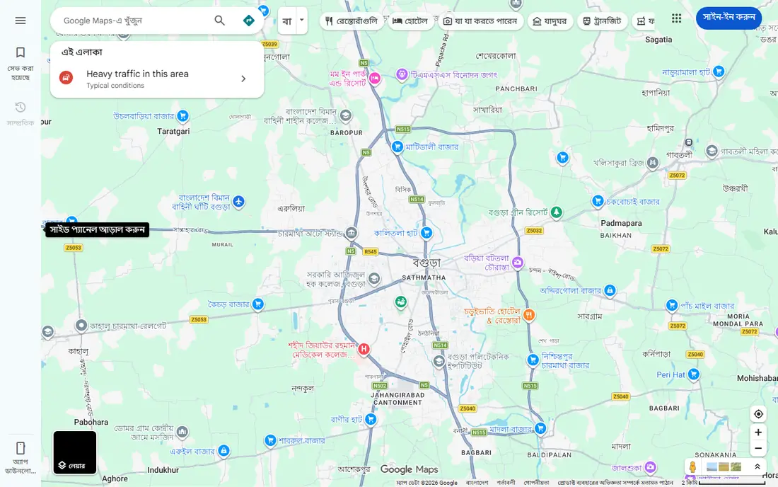
This one earns its place for a clear reason. Google Maps combines closure and traffic information with place search, transit, walking, and downloadable offline maps.
The catch is style: it is calmer and broader than Waze, so drivers who want aggressive rerouting may find it less urgent. Before you commit, check the current pricing and terms on the official site, because plans and limits change. We compared official feature pages, pricing pages, and app store listings for this guide, and we did not claim hands-on testing that did not happen.
- Closure and traffic data
- Offline maps
- Place search and multi-stop routes
- Interface can feel busy
- Live rerouting is calmer than Waze

Here the value is practical rather than flashy. Apple Maps gives iPhone drivers clear directions with incident and closure information, plus Siri control for hands-free use.
The catch is platform: Android drivers cannot use it as their main app, and smaller places may have less detail than Google Maps. Before you commit, check the current pricing and terms on the official site, because plans and limits change. We compared official feature pages, pricing pages, and app store listings for this guide, and we did not claim hands-on testing that did not happen.
- Incident reports
- Clean directions
- Offline map downloads on iPhone
- IPhone only for full app
- Place detail varies by area
What stands out here is how little setup it takes to get going. HERE WeGo suits drivers who want offline maps with traffic information, and it covers car, transit, and walking in one app.
The catch is region: traffic and closure depth is stronger in some countries than others, so test it on your usual routes. Before you commit, check the current pricing and terms on the official site, because plans and limits change. We compared official feature pages, pricing pages, and app store listings for this guide, and we did not claim hands-on testing that did not happen.
- Offline maps
- Traffic and incident views
- Car, transit, and walking modes
- Live traffic depth varies by region
- Interface is plain
This pick suits a narrower group, and that focus is its strength. TomTom GO draws on TomTom traffic data to route around jams and closures, with offline maps for areas with weak signal.
The catch is cost: the free tier covers basics, while the fullest traffic and alert features sit behind a subscription. Before you commit, check the current pricing and terms on the official site, because plans and limits change. We compared official feature pages, pricing pages, and app store listings for this guide, and we did not claim hands-on testing that did not happen.
- Traffic data from TomTom
- Speed camera alerts where allowed
- Offline maps
- Full features need a subscription
- App is driving-focused
For readers who want a calmer option, this one fits. Sygic stores detailed offline maps on the phone, so navigation keeps working where data drops out.
The catch is tiering: live traffic and some safety features need a paid plan, so the free app alone is less current on closures. Before you commit, check the current pricing and terms on the official site, because plans and limits change. We compared official feature pages, pricing pages, and app store listings for this guide, and we did not claim hands-on testing that did not happen.
- Offline 3D maps
- Live traffic on paid tiers
- Speed limit warnings
- Live traffic needs a paid plan
- Map downloads use storage
This is the pick to check when the leaders feel too heavy. MapQuest remains a simple route planner for drivers who want a quick route with traffic context and multiple stops.
The catch is depth: it is fine for planning, but drivers who need the fastest closure alerts should pair it with Waze or Google Maps. Before you commit, check the current pricing and terms on the official site, because plans and limits change. We compared official feature pages, pricing pages, and app store listings for this guide, and we did not claim hands-on testing that did not happen.
- Simple route planning
- Traffic views
- Multi-stop routes
- Live closure depth is less than Waze or Google Maps
- App is lighter on features
A quieter option can still be the right one, and this is a good example. OsmAnd uses OpenStreetMap data for offline navigation, which suits drivers and travelers who want maps without a subscription.
The catch is live data: it is strong offline, but it does not match Waze or Google Maps for live closure reports. Before you commit, check the current pricing and terms on the official site, because plans and limits change. We compared official feature pages, pricing pages, and app store listings for this guide, and we did not claim hands-on testing that did not happen.
- Offline OpenStreetMap data
- Flexible routing
- No account needed for basics
- Live traffic is limited
- Setup takes more effort
The last pick rounds out the list for a specific need. Bing Maps is useful for a quick web check of traffic and routes before a trip, with clear map and traffic overlays.
The catch is mobile use: it works best as a planning check on the web, not as a turn-by-turn driving app. Before you commit, check the current pricing and terms on the official site, because plans and limits change. We compared official feature pages, pricing pages, and app store listings for this guide, and we did not claim hands-on testing that did not happen.
- Traffic overlays
- Route planning
- Street-level views in many areas
- Web focus
- Mobile app experience is weaker than dedicated apps
How we picked these
We compared official feature pages, pricing pages, app store listings, and public reviews for each product, and we kept only products that exist, work in October 2026, and truly fit the topic. Where a price or limit could not be verified from the vendor, we wrote See website rather than guessing a figure.
How to use a map app when roads close
Check the route before you leave, then check it again after the first few miles. Closures, crashes, and roadworks change through the day, and an app that looked clear at home may reroute you once live reports arrive. If a detour looks odd, preview it on the map before you accept it.
Report what you see when it is safe to do so. A closure report from a driver on the spot helps the next driver, and map editors and authorities use those reports to confirm closures. Never report while driving; use voice reporting or wait until you can stop safely.
Keep a backup for areas with weak signal. Download the map area in Google Maps, Apple Maps, or an offline app before a rural trip, and note the main alternative road on paper or in your head. Live rerouting is useful, but it cannot help if the phone has no connection.
Frequently asked questions
Which map app shows road closures fastest?
Waze often shows driver-reported closures and hazards fastest on busy roads, because its reports come from drivers on the spot. Google Maps and Apple Maps also show closures, often from authority data and user reports combined.
Do map apps show planned roadworks as well as sudden closures?
Yes, many show planned roadworks from authorities and map editors, plus sudden closures from incidents. Planned closures are usually more reliable, while sudden closures depend on how quickly they are reported and confirmed.
Can I use a map app offline for road closures?
Offline maps give directions without a connection, but live closure updates need data. Download maps before you travel, and expect closure information to be less current until you regain signal.
Why did my app route me through a closed road?
The closure may not have been reported yet, may have been reported but not confirmed, or may apply only to certain vehicle types or times. Road signs on the ground always take priority over an app route.
Is Waze or Google Maps better for daily commuting?
Waze suits commuters who want fast hazard and closure alerts on familiar roads. Google Maps suits drivers who also need place search, transit, walking, and multi-stop routes in the same app.
Sources
See where you really rank - block by block
ProMapRanker scans Google Maps across a grid of your service area. Simple monthly plans from $19, white-label on every plan.
Start freeKeep reading
 zscaler alternatives
Best Zscaler Alternatives in 2026
Looking for zscaler alternatives? We compare 9 SASE and zero trust platforms on architecture, data protection, pricing, and fit for your network and team.
Read → zapier alternatives free
Best Zapier Alternatives Free in 2026
Nine automation tools for zapier alternatives free in 2026, all with genuinely free tiers, plus free plan limits, starting prices and upgrade paths explained.
Read → which platform is best for online reputation
Which Platform Is Best for Online Reputation in 2026
Wondering which platform is best for online reputation? We compare 8 review, listing, and response tools for small and multi-location businesses and agencies.
Read →