 ProMapRanker
Best Hurricane App in 2026: 10 Apps Compared

Key takeaways
- Pair a dedicated storm tracker with an official alert source, since radar apps and emergency apps serve different jobs.
- MyRadar, RadarScope, and Hurricane Tracker cover radar and storm tracks, while FEMA and the Red Cross cover alerts, shelters, and checklists.
- Forecasts change as storms move, so check the official forecast cone and local warnings rather than a single model line.
- Always follow local evacuation orders and official guidance, since no app replaces local emergency officials.
Quick comparison
| Pick | Great for | Pricing starts at | Free tier | |
|---|---|---|---|---|
 MyRadar | Animated radar and hurricane alerts | Free | Yes | Visit |
 RadarScope | Professional radar data | See website | No | Visit |
 Hurricane Tracker | Dedicated storm tracking | See website | No | Visit |
 FEMA App | Official alerts and shelter info | Free | Yes | Visit |
 American Red Cross Emergency | Alerts, shelters, and checklists | Free | Yes | Visit |
 The Weather Channel | Everyday forecasts plus storm coverage | Free | Yes | Visit |
 AccuWeather | Forecasts and severe weather alerts | Free | Yes | Visit |
 Windy | Model comparison and global maps | Free | Yes | Visit |
 WeatherBug | Local alerts and lightning data | Free | Yes | Visit |
 Zoom Earth | Satellite and storm visualisation | Free | Yes | Visit |
The best hurricane app
We compared official app pages, app store listings, and public reviews for hurricane and storm apps live in October 2026. Safety note: apps help you stay informed, but they do not replace official warnings or evacuation orders from local authorities. If officials tell you to leave, leave, and do not wait for an app to confirm the order.
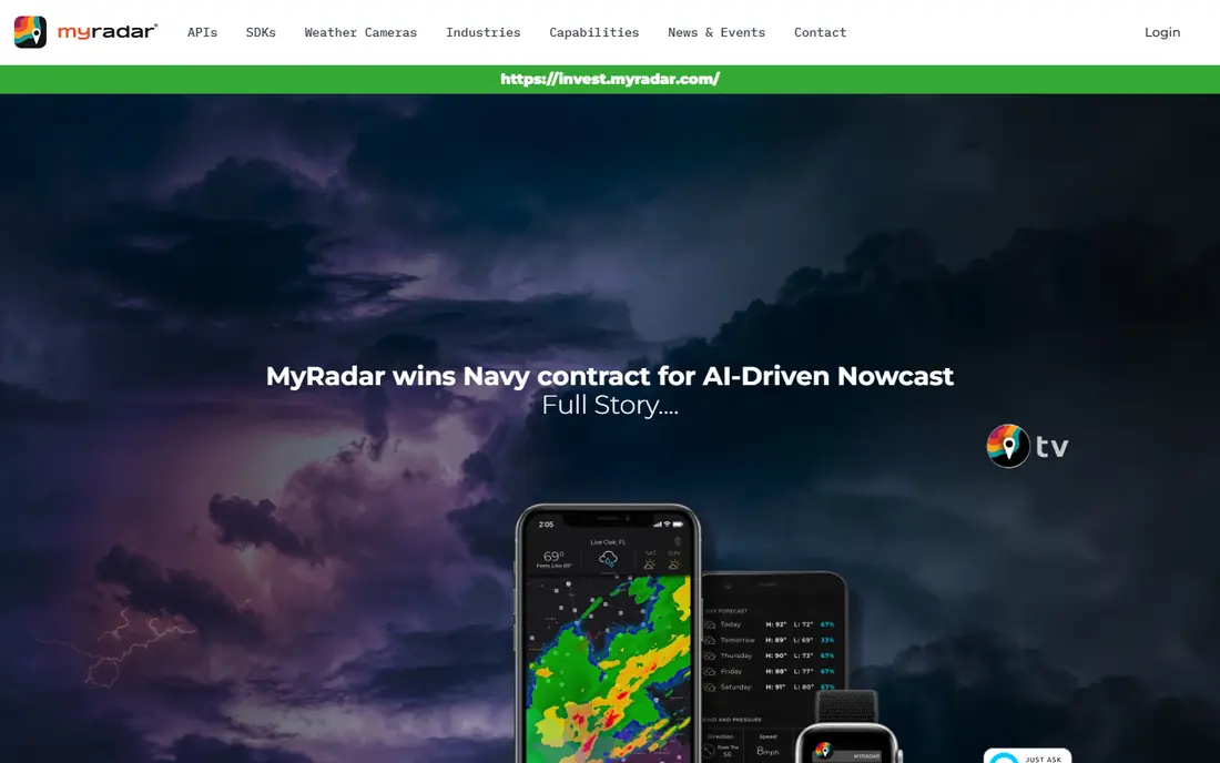
MyRadar is our pick for most people who want to watch a storm on a map. The radar animation is smooth, layers cover rain, wind, fronts, and outlooks, and users can set alerts for tropical storm and hurricane formation, upgrades, and downgrades. That mix of live radar and storm alerts makes it easy to see both where rain is now and where a named storm is headed.
The catch is that the deepest hurricane features sit behind a premium upgrade. The cone of probability, National Hurricane Center synopsis, and professional radar pack are premium, so a free user gets strong radar but less storm-specific detail. Pair MyRadar with an official alert app, and it becomes a strong everyday storm companion.
- Smooth animated radar with many map layers
- Tropical storm and hurricane alerts you can configure
- Route weather on premium tiers
- Full hurricane track cone and professional radar pack sit on premium tiers
- Radar focus needs a second app for shelter info
RadarScope suits weather enthusiasts, storm chasers, and professionals who want raw radar data rather than a simplified forecast. Users can pick individual radar sites, change tilt and product, and view velocity and rainfall products that reveal rotation and storm structure. That depth is why many broadcast meteorologists and chasers keep it on their phones.
The trade-off is learning curve and cost. RadarScope is a paid app, and a higher tier adds archives and extra detection features, so casual users may find the price and the technical interface heavy. If you want to understand a storm cell by cell, it is worth it. If you only want a simple storm track, start with a simpler app in this list.
- Direct access to NEXRAD and TDWR radar data
- Velocity, rainfall, and hail products for serious watchers
- Used by meteorologists and storm chasers
- Interface assumes weather knowledge
- Paid app with a higher tier for archives and extra detection
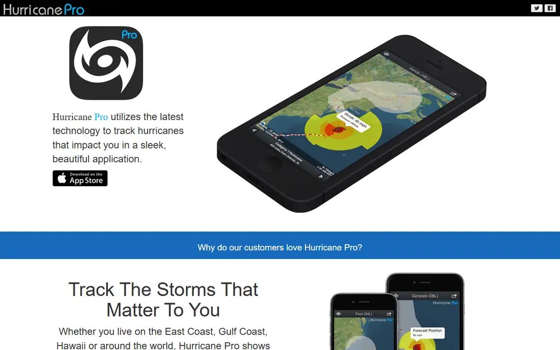
Hurricane Tracker is built for one job, which is following tropical storms and hurricanes. Storm tracks, forecast cones, model views, and storm details sit together, so a user tracking a named storm does not need to dig through general weather menus. Push alerts for formation, upgrades, and track changes help during a busy season when several storms may be active at once.
The limit is breadth. Hurricane Tracker does not replace a general weather app or an emergency app, since it lacks shelter maps, checklists, and local warning tools for other hazards. Use it as your dedicated storm tracker, and keep FEMA or the Red Cross app alongside it for alerts and safety guidance.
- Built only for tropical storms and hurricanes
- Storm tracks, cones, and model views in one place
- Push alerts for storm changes
- Narrow focus means no general weather or shelter tools
- Paid features vary by platform
The FEMA App is the official safety companion in this list. It sends real-time alerts for your saved locations, lists open shelters during disasters, and points to disaster assistance and preparedness information. That official grounding matters, since the app reflects federal guidance rather than a single forecast model or a social feed.
The trade-off is radar depth. FEMA does not offer the animated radar layers or model comparisons of MyRadar, RadarScope, or Windy, so storm watchers will want a second app for maps. For alerts, shelter locations, and what to do before and after a storm, though, FEMA is a free install that belongs on every phone in a hurricane-prone area.
- Free official app from a US federal agency
- Real-time alerts for your area
- Shelter locations and disaster help info
- Less radar detail than dedicated storm apps
- Interface is practical rather than polished
The American Red Cross Emergency app covers the human side of a storm. It sends official National Weather Service alerts by location and hazard type, shows open Red Cross shelters and services on a map, and offers preparedness guides, checklists, and quizzes for families. The app is free in English and Spanish and works with phone accessibility features, which matters in a stressful week.
The limit is radar. This is an all-hazards safety app, not a dedicated storm tracker, so users who want cones, models, and radar layers should pair it with MyRadar or Windy. For knowing what to do, where to go, and how to prepare a household, the Red Cross app is one of the strongest free options available.
- Free with official National Weather Service alerts
- Shelter map and disaster services
- Step-by-step preparedness guides and checklists
- General emergency focus rather than deep hurricane radar
- Shelter data depends on local updates
The Weather Channel app suits people who want one everyday weather app that also covers hurricanes well. Daily forecasts, hourly views, radar, and severe weather alerts sit next to storm coverage, maps, and video updates during active storms. That breadth means a user does not need to learn a new app when hurricane season starts.
The catch is presentation. The free tier carries ads that can crowd storm maps, and proprietary forecasts can differ from official National Hurricane Center guidance, so check the official cone before making decisions. Use The Weather Channel for daily weather and storm context, and confirm warnings and evacuation orders through FEMA, the Red Cross, or local officials.
- Familiar forecasts, radar, and storm news in one app
- Hurricane coverage with maps and video
- Wide US availability
- Ads on the free tier can clutter storm views
- Forecasts may differ from official guidance at times
AccuWeather fits users who plan around forecasts as much as radar. Hourly and daily views, severe weather alerts, and short-term rain timing help with decisions about travel, work, and preparation in the days before a storm. The app is widely available in the US, and its alert settings can be tuned by location and hazard type.
The trade-off is similar to other mass-market weather apps. Ads appear on the free tier, and the fullest features need a paid subscription, so the cleanest storm view costs extra. AccuWeather also adds its own forecast layer on top of official data, so compare its track with the official forecast cone during a hurricane. For planning and alerts, it remains a solid daily app.
- Detailed hourly and daily forecasts
- Severe weather alerts by location
- MinuteCast rain timing for the near term
- Free tier carries ads
- Premium features need a subscription for full access
Windy teaches why forecasters compare models instead of trusting one line. Users can switch between global models, watch animated wind and rain, and check ocean temperatures, waves, and clouds that shape hurricane growth. When models agree on a track, confidence rises, and when they diverge, the spread itself is useful information about uncertainty.
The limit is interpretation. Windy assumes a user can read model differences and knows that a single model run is not a forecast, so beginners may overreact to one dramatic track. Start with the official cone, then use Windy to understand why forecasters are confident or cautious. For global coverage and model depth, no free app in this list matches it.
- Multiple forecast models including GFS and ECMWF
- Animated wind, rain, and wave maps
- Global coverage beyond the US
- Model comparison needs weather knowledge to interpret
- Interface can overwhelm new users
WeatherBug suits users who want strong local detail during storm season. Lightning detection, local observations, and severe weather alerts help a household judge what is happening nearby, not just what a national map shows. The app is free and widely used in the US, and its local focus complements a national storm tracker.
The catch is depth on hurricanes themselves. WeatherBug covers storms as part of general weather, but it does not offer the dedicated cone, model, and storm-history tools of Hurricane Tracker or Windy. Use it for local alerts and lightning, and keep a dedicated tracker for the storm track itself.
- Local forecasts with lightning and spark data
- Severe weather alerts
- Large network of local weather observations
- Free tier carries ads
- Hurricane-specific tracking is less deep than dedicated trackers
Zoom Earth gives a view of a hurricane that radar alone cannot. Near real-time satellite imagery shows the storm structure, cloud bands, and eye from space, with storm tracks overlaid so a user can see the system in a global context. That visual clarity helps families explain a storm to children or relatives, and it works for storms worldwide, not just US landfalls.
The limits are practical. Satellite imagery refreshes on a schedule, so it does not replace fast radar updates, and Zoom Earth offers no local alerts, shelter maps, or checklists. Use it to see the storm, use MyRadar or RadarScope to see rain and wind detail, and use FEMA or the Red Cross for safety actions. Together, the three views cover a storm well.
- Near real-time satellite imagery of storms
- Storm tracks overlaid on satellite views
- Free web and app access for global storms
- Satellite views update on a schedule rather than live radar cadence
- No local alert or shelter tools
How we picked these
We compared official app pages, app store listings, and public reviews for hurricane and storm apps live in October 2026. We kept apps that offer radar, storm tracking, official alerts, shelter info, or model comparison, and that US users can install. We left out discontinued weather apps and general news apps with only occasional storm coverage, and we checked that each app still serves its stated purpose.
How to use hurricane apps safely
Start before the season with two apps, not ten. Install one tracker for maps, such as MyRadar or Windy, and one official safety app, such as FEMA or the Red Cross Emergency app, and set alerts for your home, work, and family locations. Test alerts, check that notifications are allowed, and save shelter and evacuation route information while you still have power and internet.
During a storm, check the official forecast cone and local warnings first, then use radar and models to understand detail. Do not trust a single social post, a single model line, or a screenshot of a track without checking the source and time. Charge phones early, download offline maps where possible, and keep a battery radio as a backup, since cell service can fail near landfall.
After a storm, use the safety apps for shelter, assistance, and road information, and avoid flooded roads and downed lines even when a map looks clear. Report damage through official channels rather than social feeds alone, and check on neighbours who may not have app access. Apps inform decisions, but local officials and common sense govern safety.
Frequently asked questions
What is the best hurricane app?
MyRadar is a strong all-round pick for radar and alerts, Hurricane Tracker is best for dedicated storm following, and FEMA and the Red Cross Emergency apps are best for official alerts and shelters. Most households should install one tracker plus one official safety app, rather than relying on a single app for everything.
Are hurricane apps free?
Many are free, including MyRadar, FEMA, the Red Cross Emergency app, Windy, and Zoom Earth, with premium tiers for extra features. RadarScope and Hurricane Tracker charge for their apps or premium features, so check the app store listing before buying. Free tiers cover the core safety needs for most users.
Which app is most accurate for hurricane tracking?
Accuracy comes from official data, not from a single app brand. Apps that show National Hurricane Center cones and National Weather Service radar, such as MyRadar and RadarScope, draw on official sources. Compare the official cone with model views in Windy, and treat any single model track as one possibility, not a forecast.
Do hurricane apps work without internet?
Most apps need internet for fresh radar, tracks, and alerts, and service can fail during a storm. Download maps and save key information before landfall, keep a battery radio, and follow local radio and official announcements if data service drops. Do not rely only on an app once power and networks are stressed.
Should I evacuate based on an app?
No, evacuate based on orders from local officials, not on an app alone. Apps help you see the storm and receive alerts, but evacuation zones and orders come from local emergency management. If officials order an evacuation for your area, follow it promptly and use apps for routes and shelter locations.
Sources
See where you really rank - block by block
ProMapRanker scans Google Maps across a grid of your service area. Simple monthly plans from $19, white-label on every plan.
Start freeKeep reading
 worlds best local seo company
8 Worlds Best Local SEO Companies for Map Pack Growth in 2026
Compare the worlds best local seo company options for Google Business Profile work, citations, reviews, and multi-location rankings and reporting in 2026.
Read → world's best web hosting company
World's Best Web Hosting Company in 2026
Searching for the world's best web hosting company? We compared 10 hosts on price, renewal rates, speed, and support to help you choose well today in 2026.
Read → who's got the best nanny tax services
Who's Got the Best Nanny Tax Services in 2026
We answer who's got the best nanny tax services, comparing full filing, back taxes, software, and pricing so families can handle nanny taxes correctly.
Read →