 ProMapRanker
Best Drone Roof Inspection Software in 2026


Drone mapping and 3D models · Pricing starts at: $349 per month
Key takeaways
- DroneDeploy and Pix4D are the strongest choices for turning drone flights into maps and 3D models you can measure.
- IMGING and EagleView fit roof-specific work best, with measurements and reports shaped for contractors and insurers.
- Roofr, Hover and RoofSnap help contractors sell and estimate jobs, even when they do not fly a drone themselves.
- Skydio suits teams that need autonomous flight and repeatable capture around complex structures.
- Drone rules and permissions vary by location, and operator certification may be required for commercial work.
Quick comparison
| Pick | Great for | Pricing starts at | Free tier | |
|---|---|---|---|---|
| DroneDeploy | Drone mapping and 3D models | $349 per month | No | Visit |
 IMGING | Automated roof inspections for insurers and contractors | See website | No | Visit |
 EagleView | Aerial measurement reports | See website | No | Visit |
 Roofr | Roofing sales and measurement toolbox | See website | Free trial | Visit |
 Hover | Smartphone 3D home models | See website | No | Visit |
 Pix4D | Survey-grade photogrammetry | See website | Free trial | Visit |
 RoofSnap | Aerial measurement for contractors | See website | Free trial | Visit |
 Skydio | Autonomous inspection drones | See website | No | Visit |
The best drone roof inspection software
We compared official product pages, pricing information and inspection workflows for tools that support roof work, from flight planning and processing to measurement reports and client handover. This article covers lawful, authorised inspections only. Drone rules and permissions vary by location, and operator certification may be required for commercial flights, so check the rules that apply to your job before you fly.
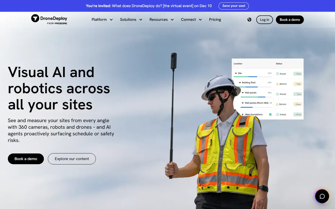
DroneDeploy is the best-known cloud platform for turning a drone flight into a usable map. You plan an automated flight in the app, the drone captures overlapping imagery, and DroneDeploy processes it into an orthomosaic, a 3D model and elevation data that you can measure, annotate and share with a client or an insurer. For roof work, that means documented condition, visible damage and measurements from one capture, without climbing onto every slope. Its strength is the full workflow in one place, from fleet and flight logs to processing and analysis. The honest catch is scope and price. DroneDeploy does not produce insurance-ready roof measurement reports out of the box in the way a roofing specialist does, and the Individual plan is priced at around 349 dollars a month on annual billing. It fits teams that already run drone programs across several job types, rather than a roofer who only needs a measurement.
- Flight planning, processing and sharing in one cloud platform
- Orthomosaics, 3D models and measurements from one flight
- Integrations with construction project tools
- General platform, not a roofing specialist
- No free plan, and annual pricing is a serious commitment
IMGING
Great for: Automated roof inspections for insurers and contractors
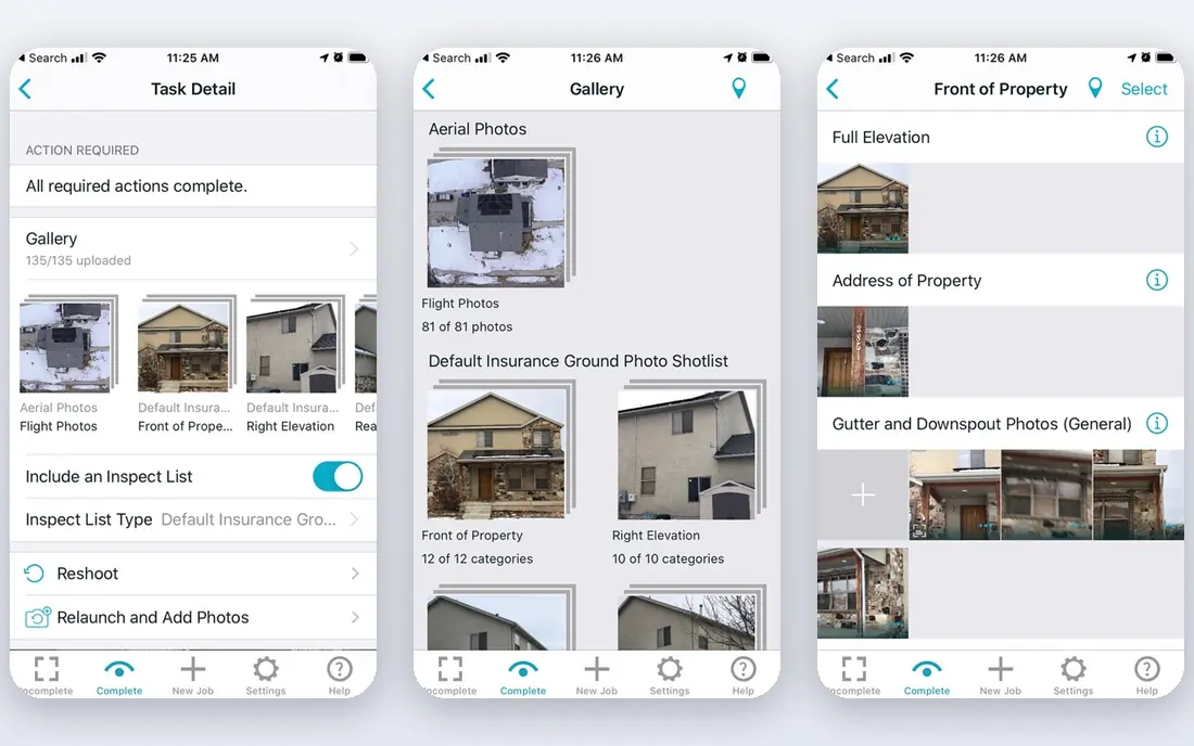
IMGING, from Loveland Innovations, is one of the few tools on this list built around roof inspections from the start. A pilot or contractor captures a property with a drone, and the platform produces models, measurements and inspection data that feed directly into bids and reports. That roof-first design saves the step of reshaping a general map into a roofing document, which is where general tools lose time. The limits are practical. Loveland Innovations does not publish pricing online, so you will need to contact the company for a quote, and the IMGING app is available on iOS devices, which rules out Android-only field teams. For insurers and larger roofing operations that run high inspection volumes, the specialist workflow can still justify that friction. Smaller crews should confirm device fit and per-inspection cost before standardising on it.
- Built for roof and property inspections, not general mapping
- On-site measurements and damage detection features
- Solar survey workflows included
- No published pricing, so budgeting needs a sales conversation
- App availability is limited to iOS devices
EagleView is the measurement name most roofing and insurance professionals already recognise. It sells aerial measurement reports built from its own high-resolution imagery, plus drone-powered inspection through its Assess product for damage detection. When a report needs to be shared with an insurer, a contractor and a homeowner, using a format the industry already accepts removes a round of explanation. The trade is cost structure. EagleView prices by report type, volume and contract, and it does not publish a simple monthly rate for casual buyers, so frequent small orders can add up. It also works without you flying a drone at all, which is a plus for desk-based estimating and a limit if you need fresh capture after a storm. Use EagleView when documentation quality and industry acceptance matter more than the lowest per-job price.
- Long-established high-resolution aerial imagery library
- Measurement reports widely recognised in roofing and insurance
- Assess product adds drone-powered inspection
- Per-report and contract pricing varies, with no simple public rate card
- Overkill if you only need a quick estimate
Roofr is aimed squarely at roofing contractors who want to measure, quote and close faster. You order or generate measurements, build a proposal with material and pricing options, and track the job in the same system, which cuts the gap between inspection and a signed contract. For a sales-led roofing business, that joined-up flow matters more than raw photogrammetry accuracy. Roofr is not a drone flight or processing platform, so teams that fly their own drones will still need a mapping tool alongside it. Pricing is also quote-based for full plans, which makes side-by-side cost comparison slower. Think of Roofr as the commercial layer on top of inspection data: strong where the job is won or lost on speed and presentation, weaker where you need to control the capture itself.
- Measurements, proposals and CRM in one roofing tool
- Fast quoting from aerial data
- Built for contractor sales workflows
- Broader sales platform, not a drone flight tool
- Pricing needs a quote for full plans
Hover turns smartphone photos into an interactive 3D model of a home, complete with measurements and material quantities that contractors use for estimates. That low barrier matters: a salesperson can capture a property during a normal visit, without a drone, a pilot or a flight plan, and share a model the homeowner can rotate and understand. It is a strong sales and documentation aid for standard residential work. The limit is physical. A phone on the ground cannot see a steep rear slope, a tall commercial roof or a storm-damaged section as completely as a drone overhead, so Hover complements drone inspection rather than replacing it. Pricing is also project-based rather than a flat monthly rate, so high-volume teams should model cost per property. For residential contractors, it is one of the easiest tools on this list to start using.
- Capture with a smartphone, no drone needed
- Interactive 3D models homeowners can explore
- Material takeoffs for estimates
- Phone capture cannot match drone coverage on large or steep roofs
- Pricing is per-scan and project-based
Pix4Dmapper and the wider Pix4D range are the photogrammetry choice when accuracy and control matter most. You can tune processing settings, work with ground control points, and produce orthomosaics, point clouds and 3D models that hold up for engineering and dispute work. Teams that already fly drones and want defensible measurements tend to land here, especially for commercial roofs and larger sites. That control comes with effort. Pix4D is less of a guided, one-button workflow than DroneDeploy, and the core mapper does not include the same integrated flight planning, so capture planning needs care. Pricing is also subscription-based with cloud options that add cost, so confirm the full stack price before you buy. If your reports may be challenged, or your roofs are complex, the extra rigour is worth it.
- Fine control over processing for accurate models
- Desktop and cloud options
- Trusted for survey and engineering deliverables
- Steeper learning curve than cloud-first rivals
- No built-in flight planning in the core mapper
RoofSnap gives contractors aerial measurements without requiring them to become drone operators. You define a roof from aerial imagery, adjust the sketch, and get measurements and takeoffs you can feed into an estimate. The mobile app keeps that workflow usable on site, which matters when a homeowner is waiting for a number and you do not want to return to the office to finish the job. The honest limit is depth. RoofSnap is an estimating tool, not a full reality-capture platform, so it will not produce the detailed 3D models or thermal analysis that a dedicated drone program can. Pricing also varies with plan and volume, so confirm what a typical month of jobs costs. For contractors who mainly need fast, credible measurements, RoofSnap hits a practical middle ground between a free sketch and a full drone program.
- Aerial measurements shaped for contractor estimating
- Sketch and takeoff tools included
- Mobile app for field use
- Measurement service pricing varies by plan and volume
- Less mapping depth than DroneDeploy or Pix4D
Skydio is different from the rest of this list because it starts with the drone itself. Its autonomous flight and obstacle avoidance let a pilot capture close, repeatable imagery around roofs, towers and other structures with less manual stick work, and its cloud software organises the resulting inspection data. For teams that inspect tall, steep or obstructed roofs often, that autonomy reduces both risk and reshoot rates. The cost is the catch. You are buying hardware plus software, and the full value appears only when you fly often enough to justify it. Skydio also fits enterprise and public-safety style programs better than a one-person roofing crew. If your bottleneck is safe, repeatable capture rather than measurement software, Skydio deserves a demo. If your bottleneck is estimating, start with a measurement tool instead.
- Autonomous flight and obstacle avoidance for close inspection
- Repeatable capture around structures
- Enterprise inspection software and fleet tools
- Hardware and software cost is high
- Best value needs an established drone program
How we picked these
We compared official product pages, pricing information and inspection workflows for tools that support roof work, keeping only products that are live in October 2026 and that produce measurements, models or reports a contractor or insurer can actually use. We included both drone platforms and measurement services, because many roofers use a mix, and we noted where pricing is quote-based so you can compare cost per inspection at your own volume.
Choosing the right inspection setup
Start by naming the deliverable your client or insurer needs. A measurement for an estimate, a damage report for a claim, and a 3D model for a large commercial roof are three different jobs, and they point to different tools. Measurement services like EagleView and RoofSnap are fastest when you need a number without flying. Mapping platforms like DroneDeploy and Pix4D are better when you need fresh capture, a model and a record you control. Check the legal and safety side before you buy software. Commercial drone work in the United States generally requires FAA Part 107 certification, and local rules, airspace limits and property permissions vary, so confirm what applies to each job and who on your team holds the right certification. Drone inspection also has a clear limit: aerial imagery documents visible condition and measurements well, but it is not a substitute for a licensed roofer's structural assessment where that matters, since a drone cannot feel soft spots, check attic conditions or assess underlayment. Use aerial data to target the physical inspection, not to replace it. Finally, cost the whole job, not just the subscription. Add pilot time, travel, processing time, report fees and reshoots for weather or poor imagery, then divide by inspections per month. A quote-based tool can be cheaper at low volume and dearer at high volume, while a flat platform subscription flips the other way. Run two or three real jobs through your shortlist before you standardise.
Frequently asked questions
Do I need a licence to inspect roofs with a drone commercially?
In the United States, commercial drone work generally requires FAA Part 107 certification, and recreational rules do not cover paid inspection work. Other countries have their own operator and registration rules. Check the rules for your location and job type before you fly, and factor training into your budget.
Can drone imagery replace a physical roof inspection?
Not entirely. Drones are strong for measurements and for documenting visible damage, but they cannot assess hidden structure, attic conditions or underlayment. Most professionals use aerial data to plan and target the physical inspection, and a licensed roofer's assessment remains important where structural questions matter.
How accurate are aerial roof measurements?
Reputable services are generally accurate within a few percent for standard residential roofs with clear imagery. Complex roofs, tree cover and outdated imagery reduce accuracy. For disputes or large commercial roofs, survey-grade photogrammetry or a fresh drone capture is more defensible than an old aerial image.
How fast can I get a measurement report?
Measurement services that use an existing imagery library often deliver within hours. A drone capture you fly yourself can give you data the same day, though processing and reporting add time. Smartphone-based models typically process within a day, depending on the provider.
What does drone roof inspection software cost?
Pricing models vary widely: per-report fees for measurement services, per-user annual licences for mapping platforms, and per-scan pricing for specialists. Compare cost per inspection at your real monthly volume, and include pilot time and hardware where you fly yourself.
Do I need to fly a drone to use these tools?
No. EagleView, RoofSnap, Roofr and Hover can all work from existing aerial imagery or smartphone photos, with no drone required. Drone platforms like DroneDeploy, Pix4D and Skydio make sense when you need fresh capture, a 3D model, or coverage that archived imagery cannot provide.
Sources
See where you really rank - block by block
ProMapRanker scans Google Maps across a grid of your service area. Simple monthly plans from $19, white-label on every plan.
Start freeKeep reading
 what’s the best risk software for enterprises
What Is the Best Risk Software for Enterprises in 2026
We compared what’s the best risk software for enterprises on risk registers, controls, third-party risk, and reporting, with pricing notes for large teams.
Read → what's the best pam software for enterprises
What is the Best PAM Software for Enterprises in 2026
Find what's the best pam software for enterprises, with vaulting, session recording, just in time access and pricing compared for large enterprise IT teams.
Read → what’s the best grc software
What Is the Best GRC Software in 2026
We compared what’s the best grc software on risk, compliance, audit and vendor risk, so teams can pick a platform that fits their frameworks and budget.
Read →