 ProMapRanker
Best Drive Time Mapping Software in 2026


Developers and analysts needing an API · Pricing starts at: See website
Key takeaways
- Drive time maps, also called isochrones, show the area reachable within a set drive time, which is far more useful than a simple radius circle.
- The best tool depends on use: a marketer needs a quick browser map, while a developer needs an API and a GIS team needs full analysis.
- Check whether times use typical traffic, live traffic or road distance alone, because each model gives a different polygon.
- Free GIS tools can match paid tools for analysis, but they need skill and setup time that a browser tool avoids.
Quick comparison
| Pick | Great for | Pricing starts at | Free tier | |
|---|---|---|---|---|
| TravelTime | Developers and analysts needing an API | See website | Yes | Visit |
 Smappen | Non technical users making isochrones fast | $99 per month | Yes | Visit |
 Maptive | Sales and territory teams with large data | $250 | Free trial | Visit |
 Mapline | Territory creation and route planning | $99 per month | Free trial | Visit |
 eSpatial | Business mapping with census data | $1,495 per year | Free trial | Visit |
 QGIS | GIS professionals wanting free control | Free | Yes | Visit |
 ArcGIS | Enterprise GIS and service areas | See website | Free trial | Visit |
 Targomo | Location analysis with travel time APIs | See website | Free trial | Visit |
The best drive time mapping software
We compared vendor feature pages, pricing pages and public reviews for drive time tools live in October 2026. We focused on isochrone accuracy, travel modes, time of day handling, data import, sharing and export, and we weighted ease of use for non GIS users alongside depth for analysts.

TravelTime is the API choice for teams that need drive time polygons inside their own product, analysis or website. Its isochrone API returns the area reachable within a set time for driving, public transport, cycling and walking, with arrival and departure times, peak and off peak models, and output in GeoJSON, KML and WKT. Because results model typical conditions rather than live traffic alone, they stay reproducible for planning and comparison.
TravelTime is not a point and click map for a casual user: it needs developer or analyst work to build a finished tool around the API. Production pricing is a fixed annual subscription based on capacity, with free developer keys for testing. For a product team, analyst or GIS user that needs accurate, repeatable drive time data at scale, TravelTime is the strongest technical option here.
- Fast isochrone API for driving, transit, cycling and walking
- Peak and off peak modelling
- GeoJSON, KML and WKT output
- API product, not a simple browser map for beginners
- Production pricing is quote based
- Integration work needed for a finished app
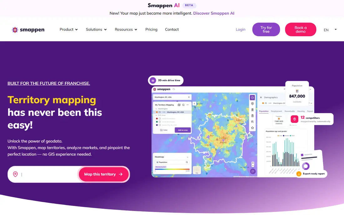
Smappen is built for a user with no GIS training: drop a pin, pick a travel mode, choose a time, and the tool draws the reachable area. That simplicity suits franchisors, retailers, estate agents and sales teams that need a quick territory or catchment map for a meeting, without learning a GIS platform. Integrations with CRM tools and spreadsheets help teams turn a map into a prospect or site list.
Smappen trades depth for speed. It will not replace a full GIS analysis with custom road networks, demographic modelling and complex queries, and its paid price suits regular business use more than a one off map. For a non technical team that needs drive time maps weekly, Smappen is the fastest route from question to shareable map.
- Browser based isochrones in three steps
- Driving, cycling and other modes
- CRM and spreadsheet integrations
- Paid plans start at a business price
- Less GIS depth than QGIS or ArcGIS
- Larger datasets need higher plans
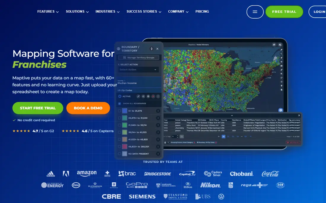
Maptive is a business mapping platform that adds drive time areas to a wider toolkit: heat maps, territory maps from ZIP codes or counties, demographic overlays and route planning. Sales and logistics teams can import a spreadsheet, draw drive time areas around stores or depots, balance territories, and share an interactive map with a team. Large datasets, including sets above 100,000 locations, are handled reliably.
Maptive pricing needs careful reading: a 45 day pass costs $250, while annual Pro and Team plans cost more, and there is no permanent free version, though a ten day trial needs no card. For a team that maps territories and drive times as core work, the breadth justifies the price. For a single isochrone, Smappen or TravelTime may be cheaper.
- Drive time polygons plus heat maps and territories
- Handles large location datasets
- Demographic overlays included
- No permanent free version
- Entry pass is a short term price, not a monthly plan
- Cost rises for teams
Mapline suits retail and sales organisations that need territories set up quickly, with drive time areas and route planning in the same tool. Auto generated territory creation saves the manual drawing that slows a sales rollout, while route tools help reps plan visits inside each territory. That combination fits a team that manages field staff across a region.
Entry plans carry data volume limits, and advanced analytics and premium support sit on a higher tier, so a large team should price the tier that covers its full dataset. Mapline also offers fewer CRM integrations than Maptive or ArcGIS. For a sales team that needs territories and drive times without a GIS project, Mapline is a practical, mid priced choice.
- Auto generated territories plus drive time tools
- Route optimisation included
- Practical for retail and sales teams
- Data volume limits on entry plans
- Fewer CRM integrations than larger platforms
- Advanced analytics need higher tiers
eSpatial is a business mapping tool that pairs drive time areas with census and demographic data, so a team can see not just where customers can drive from, but who lives there. Segmentation, filters and reporting help a retailer, insurer or service business compare sites, territories and catchments, and maps can be shared securely or exported in high resolution for presentations. Free datasets for the US, Canada, UK and other regions reduce setup time.
The annual price makes eSpatial a commitment, not a casual purchase, and new users report a learning curve with uploads and map settings. It also offers less developer API depth than TravelTime. For a business that makes site and territory decisions from maps every month, eSpatial combines drive time analysis with demographic context in one tool.
- Drive time and radius mapping with census overlays
- Segmentation, filters and reporting
- Secure sharing and high resolution export
- Annual price suits regular business use
- Interface takes learning for new users
- Less API depth than TravelTime
QGIS is the free, open source GIS platform that a skilled analyst can use to build drive time maps with complete control over data, projections, styling and queries. Plugins connect QGIS to routing engines and APIs, including TravelTime, so isochrones can be combined with other spatial datasets for detailed analysis. That control is unmatched by any browser tool in this list, and the software itself costs nothing.
QGIS needs skill: installing plugins, configuring routing, handling projections and styling output all take GIS knowledge, and support comes from the community. A non technical team will be faster with Smappen, and a team without GIS staff should budget training or a consultant. For a GIS professional or a technical team that wants free, full control, QGIS is the right foundation.
- Free open source GIS with full analytical control
- Routing plugins and API connections
- Combines isochrones with any spatial data
- Needs GIS skill and setup
- Routing setup takes configuration
- Support is community based
ArcGIS, from Esri, is the enterprise GIS standard for drive time service areas, with tools that create drive time polygons around facilities in ArcGIS Pro and ArcGIS Online. Network analysis uses road data and travel models, and results can be combined with demographic data, business data and enterprise maps. Sharing, permissions and security suit large organisations that publish maps to many teams.
ArcGIS pricing combines subscriptions and credits, which can be complex to forecast, and the platform needs GIS training to use well. A team that only needs one isochrone a month should not buy ArcGIS for that job alone. For an enterprise, government or large business team that already works in GIS, ArcGIS service areas are the most complete drive time option here.
- Service area tools for drive time in ArcGIS Pro and Online
- Rich demographic and network data
- Enterprise sharing and security
- Quote and credit based pricing can be complex
- Learning curve for new users
- Overkill for a single simple map
Targomo provides travel time analysis through APIs and visual tools, helping retailers, real estate teams and logistics planners judge locations by reachable population and travel time rather than by distance alone. Its models cover driving, public transport, cycling and walking, and results can feed site selection, delivery planning and catchment reports. Visual tools let analysts explore polygons without building a full GIS workflow first.
Targomo pricing is quote based, and its API focus still needs technical skill for a finished product, so a casual user should trial Smappen alongside it. Its brand is smaller than Esri or TravelTime, which matters for long term support planning. For a location team that wants travel time analytics without a full enterprise GIS rollout, Targomo is a focused and capable option.
- Travel time APIs and analytics for location decisions
- Driving, transit, cycling and walking modes
- Visual analysis tools
- Pricing is quote based
- API focus needs technical skill
- Smaller brand than Esri or TravelTime
How we picked these
We compared vendor feature pages, pricing pages and public reviews for drive time tools live in October 2026. We required a real drive time or isochrone capability, not just radius circles or point mapping, and we included browser tools, APIs and GIS platforms to cover different users. Where pricing is quote or credit based, we used See website rather than repeating a third party estimate as a vendor price.
What to check before you buy drive time software
Test the same origin at the same time of day in two finalists, and compare the polygons, because travel models differ. Check whether times reflect typical traffic, peak traffic or free flow roads, and whether you can set arrival versus departure times, since a morning commute polygon and a midday polygon can look very different. Confirm travel modes, maximum time limits and output formats, especially if you need GeoJSON or KML for another system.
Check data and sharing next. Confirm how many locations you can import, whether demographic data is included or extra, and how maps are shared, embedded or exported. For API tools, confirm rate limits, caching rights and total annual cost, not just a per call figure. Finally, trial the tool on a real decision, such as a new site or a territory change, and ask whether the map changed the decision, since a pretty polygon that no one acts on is not worth a subscription.
Frequently asked questions
What is a drive time map?
A drive time map, also called an isochrone map, shows the area you can reach by driving within a set time, such as 15, 30 or 45 minutes, from a starting point. Unlike a radius circle, it follows the road network, so rivers, highways and one way streets shape the area. It is used for site selection, territories, delivery planning and catchment analysis.
Is drive time better than a radius for site analysis?
Usually yes, because customers travel on roads, not as the crow flies. A store across a river with no nearby bridge may look close on a radius map but sit far away by drive time. Radius maps still suit a quick first look, but drive time maps give a truer catchment for retail, healthcare and service planning.
Do drive time tools use live traffic?
Some tools model typical traffic for a time of day, some use live traffic, and some use road speeds without traffic, so results differ. TravelTime models typical conditions for reproducibility, while other tools vary by plan and data source. Check the model for your tool, and compare polygons at peak and off peak times before making a site decision.
Can I make a drive time map for free?
Yes, with limits. QGIS is free open source software, TravelTime offers free developer keys, and several browser tools offer free tiers or trials. Free options may cap locations, views or features, and QGIS needs GIS skill. For occasional maps, a free tier or trial is often enough; for regular business use, a paid plan is usually better value.
What file formats do drive time maps export as?
Common formats include GeoJSON, KML and WKT for polygons, plus image and PDF exports for presentations. API tools such as TravelTime offer GeoJSON, KML and WKT directly, while business mapping tools add sharing links and high resolution exports. Confirm the format your other systems need before buying, since converting polygons can lose detail.
Sources
See where you really rank - block by block
ProMapRanker scans Google Maps across a grid of your service area. Simple monthly plans from $19, white-label on every plan.
Start freeKeep reading
 what’s the best risk software for enterprises
What Is the Best Risk Software for Enterprises in 2026
We compared what’s the best risk software for enterprises on risk registers, controls, third-party risk, and reporting, with pricing notes for large teams.
Read → what's the best pam software for enterprises
What is the Best PAM Software for Enterprises in 2026
Find what's the best pam software for enterprises, with vaulting, session recording, just in time access and pricing compared for large enterprise IT teams.
Read → what’s the best grc software
What Is the Best GRC Software in 2026
We compared what’s the best grc software on risk, compliance, audit and vendor risk, so teams can pick a platform that fits their frameworks and budget.
Read →