 ProMapRanker
Best Alternatives to Google Earth in 2026

Key takeaways
- Zoom Earth and Bing Maps are the closest free options for casual browsing, weather and street level views.
- ArcGIS Earth and QGIS suit people who need to open, measure and work with map data, not just look at it.
- NASA Worldview and Sentinel Hub EO Browser are better when image date and data type matter more than a pretty globe.
- OpenStreetMap and Mapbox suit builders and editors, while HERE WeGo and MapQuest suit everyday navigation.
Quick comparison
| Pick | Great for | Pricing starts at | Free tier | |
|---|---|---|---|---|
 Zoom Earth | Weather and satellite browsing | Free | Yes | Visit |
 Bing Maps | Everyday maps and street views | Free | Yes | Visit |
 ArcGIS Earth | 3D data and KML files | Free | Yes | Visit |
 QGIS | Full GIS analysis | Free | Yes | Visit |
 NASA Worldview | Science imagery by date | Free | Yes | Visit |
 OpenStreetMap | Community maps and data | Free | Yes | Visit |
 Mapbox | Custom maps for apps | Free | Yes | Visit |
 HERE WeGo | Offline navigation | Free | Yes | Visit |
 Sentinel Hub EO Browser | Recent satellite imagery | Free | Yes | Visit |
The best alternatives to google earth
Google Earth is hard to replace with one tool because it mixes browsing, 3D views, measurement and data. The tools below each cover part of that mix well, so start from the job you have in mind and pick from there.
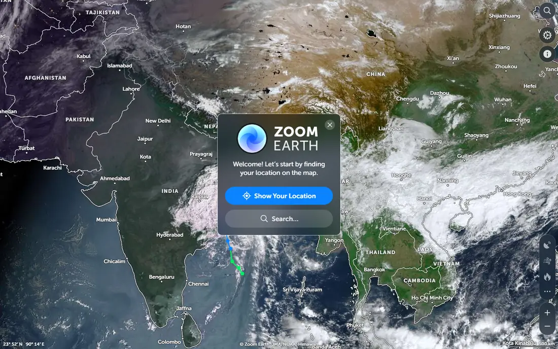
Zoom Earth is our pick for most casual browsers. It opens in a browser, shows satellite imagery, and adds weather layers such as rain, wind and storms in a way that is easy to read. You can move around the planet without installing software or learning GIS terms.
The catch is scope. Zoom Earth is a viewer first, so it does not replace a desktop GIS tool for editing data or building a detailed project. For checking a place, tracking weather or comparing recent views, though, it is quick and free to start.
- Fast satellite and weather layers
- Recent imagery in many places
- Simple web view
- Fewer measurement tools than a GIS app
- Some layers need a paid plan for full detail
Bing Maps is the most familiar option on this list for daily use. It pairs road maps with aerial imagery and street level views, and it handles directions and local search in the same place. If you mainly want to look at a neighbourhood, find a route or check what a street looks like, it does that well.
It is not a data tool. You will not get the same file support or analysis options as ArcGIS Earth or QGIS. As a free browser alternative for browsing and navigation, it is a solid first stop.
- Street level imagery in many cities
- Clear road maps and directions
- No install needed
- Satellite detail varies by place
- Fewer 3D globe features than Google Earth
ArcGIS Earth comes from Esri and is built for people who have map files to open. It shows data on a 3D globe, lets you measure distance and area, and works with common formats that Google Earth users already know. That makes it a natural next step when a browser viewer feels too limited.
The trade is effort. You need to download and install it, and the interface assumes some comfort with map data. For classroom work, planning or a personal mapping project, that extra weight is worth it.
- Opens KML and other geographic files
- 3D globe view
- Measurement tools
- Desktop install required
- Heavier than a simple web viewer
QGIS is not a casual globe viewer, and that is the point. It is a full geographic information system that lets you load, edit, style and analyse map layers, then export a finished map. Students, researchers and local planners use it for work that a viewer cannot do.
Beginners should expect a learning curve. The menus are deep, and simple tasks can take a few tries at first. If your goal is analysis rather than sightseeing, QGIS gives you the most capability here for no licence cost.
- Free and open source
- Broad file format support
- Plugins extend what it can do
- Steep learning curve
- Interface can feel busy for casual browsing
NASA Worldview is the pick when you care about when an image was taken. It lets you browse satellite layers by date, compare days, and look at events such as fires, storms and dust in near real time for supported layers. Teachers and researchers value that date control.
It will not help you find a shop or plan a drive. The maps are about Earth observation, not roads and businesses. Use it alongside a road map tool when you need both context and science data.
- Dated satellite layers from NASA missions
- Easy date comparison
- Free to use
- Focused on science data, not street maps
- Imagery is not a live video feed
OpenStreetMap is a community built map and a data source at once. The main site lets you browse, search and edit, and the underlying data powers a large number of other apps and services. That openness matters for projects, education and places where commercial maps are thin.
As a direct Google Earth replacement, it is less visual. You get maps and data, not a cinematic globe with built in tours. For building, editing or reusing map data, it is one of the most useful options here.
- Open map data anyone can use and edit
- Strong coverage in many places
- Many apps built on it
- No single polished 3D globe app
- Editing quality varies by area
Mapbox is for people who want to put a map inside their own app or site. It offers map design tools, satellite imagery and developer kits, and many well known apps use its maps behind the scenes. Design control is the main draw, from colours and labels to which layers appear.
Casual users should skip it as a viewer. There is no simple globe app to open and explore in the Google Earth sense. If you build products, though, Mapbox is a practical and well documented choice.
- Strong tools for custom map design
- Satellite tiles for apps and sites
- Free tier for small use
- Built for developers, not casual browsing
- Costs grow with heavy use
HERE WeGo suits travellers and drivers more than data users. It offers maps, directions and offline downloads for supported areas, so you can keep navigating when signal is weak. The web version is handy for quick route checks.
It does not try to be a 3D globe or a science viewer. Satellite imagery and measurement options are thinner than in the tools above. Pick it when the trip matters more than the imagery.
- Offline maps for supported areas
- Driving, walking and transit directions
- Free app
- Satellite view is limited
- Fewer data tools than desktop GIS options
Sentinel Hub EO Browser is built for people who want recent Earth observation images with clear source and date information. You can search by place and date, view different band combinations, and compare images over time. That is useful for farming, research, environmental checks and teaching.
It assumes you know a little about satellite data, or are willing to learn. It will not give you street views or turn by turn directions. For current imagery work, it fills a gap that casual globe apps leave open.
- Recent Sentinel and Landsat imagery
- Comparison and visualisation options
- Free browser access
- Needs some familiarity with satellite data
- Not a road navigation tool
How we picked these
We compared official product pages, pricing and feature descriptions, and public documentation for each tool. We kept only tools that are live and usable in October 2026, and we favoured a mix of free viewers, data tools and navigation apps so different readers can find a fit. We did not claim hands on testing, and prices marked Free reflect the core web or desktop use described on the vendor site, with paid tiers where noted.
How to choose the right replacement
Start with the main job. For browsing and weather, a web viewer such as Zoom Earth or Bing Maps is enough. For files, measurement or analysis, move to ArcGIS Earth or QGIS. For science or recent imagery, check NASA Worldview or EO Browser first, and check the image date before you rely on it for a decision.
Check imagery date and coverage
Satellite images are often months old, and detail varies by place. Look for a date label, zoom into your exact area, and compare two sources when a decision depends on what is on the ground now.
Match the tool to your skill level
A GIS app will frustrate a casual browser, and a simple viewer will frustrate a researcher. Pick the simplest tool that does the job, and only move to a heavier tool when you hit a real limit.
Frequently asked questions
What is the best free alternative to Google Earth?
Zoom Earth and Bing Maps are the best free starting points for browsing, while ArcGIS Earth and QGIS are the best free options for working with map files. The right pick depends on whether you want to look around or to analyse data.
Can I open KML files in these alternatives?
Yes, ArcGIS Earth and QGIS both support common geographic file formats, including KML. Open the file in the desktop app, check that layers load in the right place, and save your project in the app format if you plan to edit it.
Are satellite images in these tools live?
No, most satellite images are not live video. Weather layers update often, while detailed ground imagery can be weeks or months old. Always check the date shown by the tool before treating an image as current.
Which alternative works offline?
HERE WeGo supports offline maps for supported areas, and ArcGIS Earth and QGIS can work with data stored locally. Web viewers such as Zoom Earth need an internet connection for imagery and layers.
Do I need GIS skills to use these tools?
No for web viewers and navigation apps, which are made for general use. QGIS and, to a lesser degree, ArcGIS Earth assume more map knowledge, so allow time to learn the basics if you choose them.
Sources
See where you really rank - block by block
ProMapRanker scans Google Maps across a grid of your service area. Simple monthly plans from $19, white-label on every plan.
Start freeKeep reading
 zscaler alternatives
Best Zscaler Alternatives in 2026
Looking for zscaler alternatives? We compare 9 SASE and zero trust platforms on architecture, data protection, pricing, and fit for your network and team.
Read → zapier alternatives free
Best Zapier Alternatives Free in 2026
Nine automation tools for zapier alternatives free in 2026, all with genuinely free tiers, plus free plan limits, starting prices and upgrade paths explained.
Read → which platform is best for online reputation
Which Platform Is Best for Online Reputation in 2026
Wondering which platform is best for online reputation? We compare 8 review, listing, and response tools for small and multi-location businesses and agencies.
Read →